New Jersey resiliency models will help small towns plan for storms
Hurricane Sandy caused $37 billion of damage in New Jersey. But what if municipal leaders could have better anticipated the storm damage?

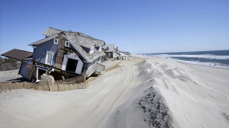
In April 2013, homes severely damaged by Superstorm Sandy line the beach in Mantoloking, N.J. (AP Photo/Mel Evans, File)
Hurricane Sandy caused $37 billion of damage in New Jersey. But what if municipal leaders could have better anticipated the storm damage?
A team of engineers at Rowan University in South Jersey is working to create a more accurate picture of risks associated with storms.
The researchers are building models with 50 to 60 layers of data that include everything from hyperlocal land elevation, to infrastructure height and material, vegetation, tides, and sea level rise. By calculating how each of these factors affects one another, the engineers will be able to project total flood and damage levels in a given scenario.
Existing flood maps generally focus on national and regional predictions. The New Jersey models, which will be available online in two to three months, will provide higher resolution information. That means individuals and decision makers will be able to zoom in on small towns, problem blocks, and even properties to predict how different scenarios will play out during a storm.
“If you’re trying to do construction, you can’t use national models for construction purposes, for planning purposes,” said Rowan assistant professor Rouzbeh Nazari, who heads the project. “If you’re planning for a pump station, you can’t use national models.”
Nazari’s team is also building virtual reality capability, so decision makers can better see what’s at stake. They’ll be able to plug in storm metrics and see how their jurisdiction fares and, from there, decide where to invest in resilience infrastructure or response plans.
“It helps to visualize information in a 3-D environment. And you get a sense of what it means to have 3 feet of flood or 4 feet of flood. What it means and what would it look like around the community,” Nazari said.
Smaller municipalities may not have the money or skills to do independent, in-depth resiliency planning, Nazari said, and these models can help them plan — before, during and after a storm.
WHYY is your source for fact-based, in-depth journalism and information. As a nonprofit organization, we rely on financial support from readers like you. Please give today.


