Master plan in works for northern Delaware’s largest state park
The park plays a significant role in Delaware's history — or more accurately — in Delaware geography.

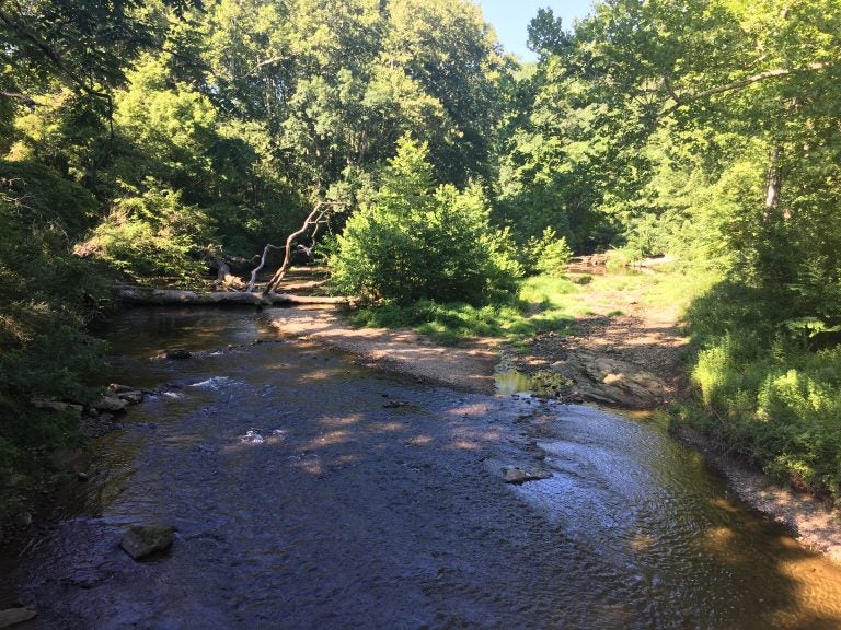
White Clay Creek runs through New Castle County's largest state park. (Mark Eichmann/WHYY)
Just a short drive from Wilmington sits a natural oasis in the midst of the bustle of crowded New Castle County development. More than 3,000 acres in size, White Clay Creek State Park draws more than 200,000 visitors annually. Just a short distance from the University of Delaware, the park offers a quiet place for recreation and reflection.
Some 30-miles of trails criss-cross the park’s rolling hills and through lush forests popular with hikers and bikers. It’s also a popular spot for anglers hoping to catch trout and other fish the state stocks in the park’s waters.
The state Department of Natural Resources and Environmental Control is now in the process of creating a master plan for future infrastructure and investments at the park. As that process moves forward this summer, one state leader has a unique perspective on White Clay. Shawn Garvin grew up very close to the park, and the DNREC secretary has a personal stake in the master planning process.
“This was the park I literally grew up in,” Garvin said, as he remembered meeting up with friends to head to the park. “We used to load up our bikes and go about 100 yards and we were in White Clay Creek State Park.”
As part of the master plan process, Garvin is gathering public comments on how the park is used and how those users think investments should be made in the future.
“The focus and goal is for us to have a road map on how we proceed,” said Garvin, adding that the state doesn’t currently have a set plan and is looking for input from residents and users of the park.
A number of those park users are members of the Friends of White Clay Creek State Park, a group led by David Koppeser. He said one priority should be maintaining historic structures in the park.
“There are things such as the buildings, especially the historical buildings, that should have some specific funding or some arrangement to continue to preserve those,” Koppeser said. Some buildings should be upgraded so they can be inhabited or used in an active way, he said.
The park plays a significant role in Delaware’s history — or more accurately — in Delaware geography. One of the dozens of trails that meanders through the park leads to the Arc Corner Monument, the place where the round northern border of the state meets the Pennsylvania line. The arc corner was marked by surveyors Charles Mason and Jeremiah Dixon in 1765. Mason and Dixon’s border line would become the unofficial dividing line separating Northern and Southern and marking the northern limit of slavery in the U.S.
But much of this history almost sank — along with much of the park land — in the 1960s when plans were in the works for a massive reservoir.
“A lot of this land was originally part of a DuPont land parcel and there was going back a few decades a move to put a very large reservoir,” Koppeser said. “People in the community fought that, got public support and politicians’ support, and eventually that dam project was deferred and as a result a lot of land for recreation use and trails and cycling and so on was preserved.”
Continuing to preserve that use in the right way can have big economic impacts for the state.
“When you’re able to drop something like this into an area that’s densely populated, it’s tough to put a value on that,” Garvin said.
Every dollar invested by the state into the park returns $40 to the state’s economy, according to Garvin. “It is a valuable part of our economy, but it’s also very critically important to Delawareans.”
Another public hearing on the master plan is scheduled for Aug. 20 to focus on the future of roads and trails, as well as recreation opportunities for golf and fishing.
“I see it as an ongoing living process that takes into account people’s variety of needs and wants and fits them into a long term preservation,” Koppeser said. “It’s something that we will, I think in future generations, treasure having this amount of land preserved for a variety of uses.”
You can find more information on public meetings and the master plan at DEStateParks.com.
WHYY is your source for fact-based, in-depth journalism and information. As a nonprofit organization, we rely on financial support from readers like you. Please give today.


