Jersey Shore mayor wants to dredge waterways, use material to build back bay berms

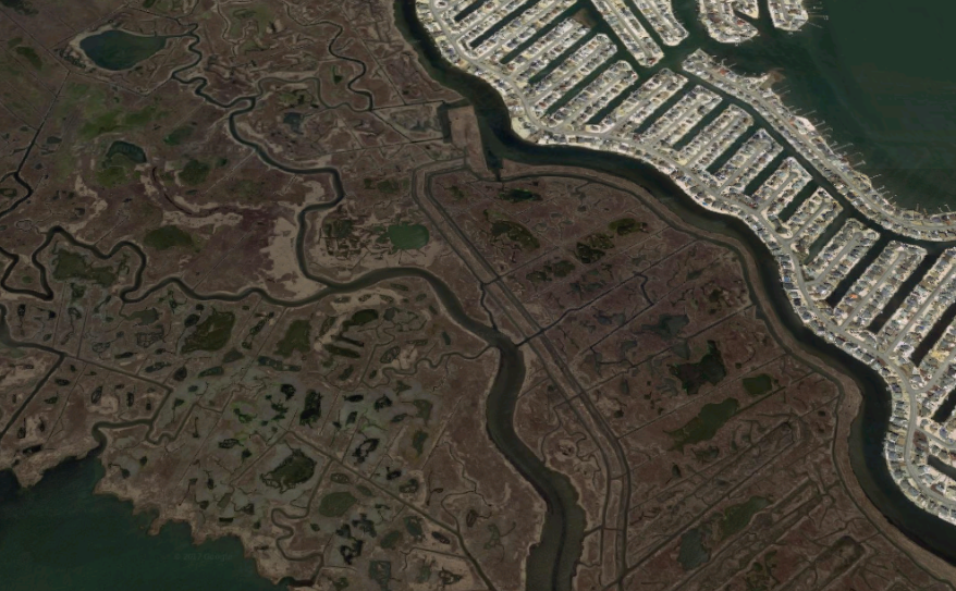
An expansive salt marsh next to the Beach Haven West section of Stafford. The area was severely flooded during Superstorm Sandy. (Google Maps image)
One Jersey Shore mayor has a plan that he thinks can mitigate the back bay flooding problem.
Stafford Township Mayor John Spodofora announced this week at a township council meeting that his vision is to dredge lagoons and portions of the Barnegat Bay and then use the material to build berms on sedge islands within the bay, The Sandpaper reports.
Spodofora says the plan will not just mitigate future flooding events but will also improve ecosystems in the Barnegat Bay.
His theory, according to the newspaper report, is that the berms will serve as speed bumps to reduce flood inundation. The mayor is working to build a coalition of bay municipalities in an effort to lobby state and federal officials.
Last year, nearby Little Egg Harbor successfully tested the use of compost bales weighing up to 38,000 pounds to provide a “breakwall” along a portion of the municipality’s back bay frontage. Although it was only meant to be a temporary solution, township officials said at the time that they would investigate a permanent fix.
The state said last year that officials were investigating structural improvements and natural solutions to back bay flooding. NJ Spotlight reported at the time that the state was working with the U.S. Army Corps of Engineers on pilot projects to raise the elevation of salt mashes with dredged sand and sediment to mitigate flooding.
Tim Dillingham, executive director of the American Littoral Society, told the online publication that building up and maintaining salt marshes to reduce flooding is a better solution than hard defenses.
But at a public meeting late last year, an Army Corps official said that a comprehensive state and federal resiliency and flood mitigation plan won’t be ready for at least three years. From there, it will take longer to implement.
The plan aims to investigate problems and provide solutions to reduce damages from coastal flooding impacting people, infrastructure, facilities, property, and ecosystems. They’re exploring everything from building levees to relocating vulnerable structures.
The study area covers approximately 950 square miles and nearly 3,400 miles of shoreline within the network of interconnected tidal waterways through Monmouth, Ocean, Burlington, Atlantic, and Cape May counties.
WHYY is your source for fact-based, in-depth journalism and information. As a nonprofit organization, we rely on financial support from readers like you. Please give today.

