Ideas worth stealing: [Re]moving urban highways

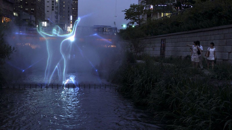
A laser light display is shown in misting fountains of the Cheonggyecheon river in central Seoul, South Korea. (AP Photo/Wally Santana)
As city leaders reconsider their waterfronts through the lens of a post-industrial economy, moving urban highways has become more of a priority.
Ideas Worth Stealing: Every week, Keystone Crossroads will look to cities across the world for lessons in urbanism and municipal governance that could benefit Pennsylvania. No city does it all right, and we hope these examples from metropolises near and far inspire and encourage cities here to think outside the box.
Some of the best views of Pittsburgh are from the city’s highways. They snake along the Allegheny, the Monongahela, and the Ohio Rivers, opening up to city skylines and views of the rivers, while delivering drivers relatively swiftly to different parts of the city and, perhaps more poignantly, the suburbs. But these roads also block access to the rivers – you can see the water, but you can’t always approach it.
Most of these roads were built after World War II, to ease congestion. “The circulation of downtown was going to be an outer loop,” said Ted Muller, a University of Pittsburgh historian. “And how do you do an outer loop in our downtown? Well, it has to be along the riverfronts.” It’s the same in city after city, where planners relinquished waterfront access to car traffic.
But many cities are rethinking that strategy. As city leaders reconsider their urban spaces – and particularly, urban waterfronts – through the lens of a post-industrial economy and renewed urbanism, moving these urban highways has become more of a priority.
And it’s not just about waterfronts, either; highways can blight the neighborhoods they pass through, removing them can increase property values, and they’re expensive to maintain, according to a report by the Institute for Transportation and Development Policy. “In the United States, availability of ninety percent federal funding for roads was an incentive to build highways. Today, diminished federal funding and a growing reliance on private financing is spurring cities to more closely scrutinize costly investments. The costs of reconstruction and repair can be a compelling reason for cities to decide to remove highways,” the report says.
On the other hand, these kinds of projects can be prohibitively expensive: Boston’s Big Dig infamously ballooned to more than $14 billion. That’s over $10 billion more than it was supposed to cost, and that doesn’t even include interest.
While Philadelphia isn’t moving its highways, yet, there is a proposal to cap a section of Interstate-95 and build a park extending down to the Delaware River atop it. Pittsburgh hasn’t seriously studied any plans to move or change its highways. But as Pennsylvania’s cities continue to redevelop their waterfronts, here are just some ideas from cities near and far for highway reconfiguration.
Seattle:
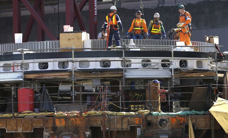
Seattle is in the midst of restructuring its own urban freeway, the Alaskan Way Viaduct. A waterfront section of the double-decker highway will be sunk into a tunnel, opening access to Elliott Bay. The highway removal is part of a larger plan, which includes building new surface streets connecting the bay to downtown, as well as new parks and paths along the waterfront. You may have heard that Big Bertha, the tunnel boring machine, has had some issues.

Workers stand on the cutting head of the Seattle tunnel boring machine, Friday, July 17, 2015, in Seattle. The head had to be brought to the surface after the machine stalled deep underground while drilling the tunnel to replace the Alaskan Way Viaduct elevated roadway. (AP Photo/Ted S. Warren)
You can follow Bertha’s progress once she gets back to work. The project is estimated to cost $3.1 billion, but like Boston’s Big Dig, and especially in light of Big Bertha’s problems, that could rise.
Portland, Oregon:
One of the first freeway removal projects in the U.S., Portland razed the Harbor Drive freeway in 1974 and replaced it with a 37-acre park along the Willamette River. Two other, parallel highways absorbed the traffic. The road removal stemmed at least in part form the city’s 1968 Downtown Waterfront Plan, which sought ways to beautify the downtown riverfront. The park is the only direct access point to the river; since the freeway’s removal the waterfront has seen mixed commercial and residential development, property values have more than tripled, growth in the area has outpaced the rest of the city, and crime has gone down more than in the rest of the city.
San Francisco:
The Embarcadero Freeway, also known as State Route 480, was a double decker highway that ran along the San Francisco Bay. There were proposals to demolish it as early as 1986 (they were rejected due to concerns over congestion), but in 1989 the Loma Prieta earthquake damaged the road beyond repair. Down it went. In its place dense commercial development sprang up. Housing and jobs in the area increased, and the city built a public plaza and waterfront promenade, as well as a boulevard to replace the highway. Property values in the adjacent neighborhoods went up 300 percent. Public transit ridership went up and the street grid absorbed some traffic. The new, street-level boulevard is also capable of carrying many cars. The project cost $171 million. All it took for this early highway removal was a force of nature.
Seoul, South Korea:
Cheonggyecheon was a creek that grew narrower and filthier as development encroached on its banks until it was covered completely by a 4-lane highway running through the center of Seoul. By the 1990s the elevated highway was in poor structural shape and the city started evaluating maintenance costs and the adverse effects the road had on the central business district. City leaders decided to remove the highway; then the stream was uncovered, cleaned up, and walkways and a park were built along its edges. Public art and furniture were commissioned for the riverwalk. The city also started restricting cars and increased public transport in the areas, in part by designating special street lanes exclusively for buses. The project cost $281 million. It was not universally popular; vendors who faced displacement due to the project held large rallies protesting the change.
This project is unique in that it actually uncovered a waterfront, rather than just re-opened access to one. By 2007, just two years after completion of the restoration, 56 million people had visited Cheonggyecheon. Cities in Pennsylvania, including Philadelphia and Pittsburgh, are sitting on many buried streams.
There are many other examples of these kinds of projects : Chattanooga’s Riverfront Park, New Jersey’s Route 29 restructuring, Paris’ Pompidou Expressway, New York City’s West Side Highway, Bogota’s Inner Ring Expressway, Milwaukee’s Park East Freeway. The list goes on.
Maybe a Pennsylvania city will make it on that list soon.
WHYY is your source for fact-based, in-depth journalism and information. As a nonprofit organization, we rely on financial support from readers like you. Please give today.


