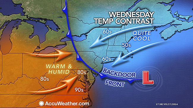
Backdoor cold front arrives, brings much cooler air

A backdoor cold front swept into the area from New England early Wednesday morning, dropping temperatures nearly 30 degrees in some locations.
Conditions have changed rapidly due to a combination of a dramatic temperature gradient, damp marine air mass, and cloud cover, according to John Homenuk, lead forecaster at New York Metro Weather.
“The clouds, drizzle and damp air on Wednesday will carry over into Thursday and Friday, although the latter two days will feature some more peaks of sun. Most notably, yet another upper level trough will sink southward from New England during this weekend,” Homenuk said. “Although widespread showers are not expected, cooler than normal temperatures will prevail and north winds will develop very similarly to last weekend. Showers and thunderstorms will be possible during the afternoon hours with cool air aloft.”
So when will we finally see prolonged warm weather?
While Homenuk says we could see another temperature moderation early next week, the area is entrenched in a pattern that is more favorable for cooler, wet weather.
WHYY is your source for fact-based, in-depth journalism and information. As a nonprofit organization, we rely on financial support from readers like you. Please give today.

