Winter storms and rain sweep across the U.S. while a new system is expected to arrive for Thanksgiving
Blizzard or winter storm warnings were in effect Saturday from parts of the Northeast to central Appalachia.
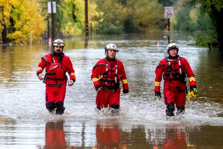
Firefighters walk through floodwaters while responding to a rescue call in unincorporated Sonoma County, Calif., on Friday, Nov. 22, 2024. (AP Photo/Noah Berger)
A major storm dropped more snow and record rain in California, causing small landslides and flooding some streets, while on the opposite side of the country blizzard or winter storm warnings were in effect Saturday for areas spanning from the Northeast to central Appalachia.
Another storm system is expected to arrive for Thanksgiving week and linger into Tuesday in the Pacific Northwest, dumping rain as well as snow in the higher elevations, according to Torry Dooley, meteorologist with the National Weather Service.
The Midwest and Great Lakes regions will also see rain and snow Monday while the East Coast will be the most impacted by weather on Thanksgiving and Black Friday.
A low pressure system will bring rain to the Southeast early Thursday before heading to the Northeast, where areas from Boston to New York could see rain and strong winds. Parts of northern New Hampshire, northern Maine and the Adirondacks could get snow. If the system tracks further inland, the forecast would call for less snow for the mountains and more rain.
Deadly ‘bomb cyclone’ roared ashore on West Coast
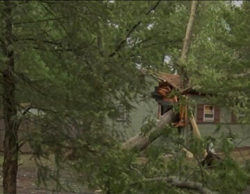
The storm on the West Coast arrived in the Pacific Northwest earlier this week, killing two people and knocking out power to hundreds of thousands, mostly in the Seattle area, before its strong winds moved through Northern California. The system roared ashore on the West Coast on Tuesday as a “ bomb cyclone,” which occurs when a cyclone intensifies rapidly. It unleashed fierce winds that toppled trees onto roads, vehicles and homes.
Santa Rosa, California, saw its wettest three-day period on record with about 12.5 inches (32 centimeters) of rain falling by Friday evening, according to the National Weather Service in the Bay Area.
Flooding closed part of scenic Highway 1, also known as the Pacific Coast Highway, in Mendocino County and there was no estimate for when it would reopen, according to the California Department of Transportation.
Meanwhile, on the East Coast, another storm brought much-needed rain to New York and New Jersey, where rare wildfires have raged in recent weeks, and heavy snow to northeastern Pennsylvania. Parts of West Virginia were under a blizzard warning through Saturday morning, with up to 2 feet (61 centimeters) of snow and high winds making travel treacherous.
Tens of thousands lose power in Seattle area
As residents in the Seattle area headed into the weekend, more than 87,000 people were still without power from this season’s strongest atmospheric river — a long plume of moisture that forms over an ocean and flows through the sky over land. Crews worked to clear streets of downed lines, branches and other debris, while cities opened warming centers so people heading into their fourth day without power could get warm food and plug in their cellphones and other devices.
Gale warnings were issued off Washington, Oregon and California, and high wind warnings were in effect across parts of Northern California and Oregon. There were winter storm warnings for parts of the California Cascades and the Sierra Nevada.
Forecasters predicted that both coasts would begin to see a reprieve from the storms as the system in the northeast moves into eastern Canada and the one in the West heads south.
By Friday night, some relief was already being seen in California, where the sheriff’s office in Humboldt County downgraded evacuation orders to warnings for people near the Eel River after forecasters said the waterway would see moderate but not major flooding.
Northeast gets much needed precipitation
In the Northeast, which has been hit by drought, more than 2 inches (5 centimeters) of rain was expected by Saturday morning north of New York City, with snow mixed in at higher elevations.
Despite the mess, the precipitation was expected to help ease drought conditions in a state that has seen an exceptionally dry fall.
“It’s not going to be a drought buster, but it’s definitely going to help when all this melts,” said Bryan Greenblatt, a National Weather Service meteorologist in Binghamton, New York.
Heavy snow fell in northeastern Pennsylvania, including the Pocono Mountains, prompting a raft of school closures. Higher elevations reported up to 17 inches (43 centimeters), with lesser accumulations in valley cities like Scranton and Wilkes-Barre. Less than 80,000 customers in 10 counties lost power, and the state transportation department imposed speed restrictions on some highways.
Parts of West Virginia also experienced their first significant snowfall of the season Friday and overnight Saturday, with up to 10 inches (25.4 centimeters) accumulating in the higher elevations of the Allegheny Mountains. Some areas were under a blizzard warning as gusty winds made travel conditions dangerous.
The precipitation helped put a dent in the state’s worst drought in at least two decades. It also was a boost for West Virginia ski resorts preparing to open their slopes in the weeks ahead.
___
Rodriguez reported from San Francisco. Associated Press writers Hallie Golden in Seattle, Janie Har in San Francisco, Manuel Valdes in Issaquah, Washington, Sarah Brumfield in Washington, D.C., Michael Rubinkam in Pennsylvania, John Raby in West Virginia and Lea Skene in Baltimore contributed.
WHYY is your source for fact-based, in-depth journalism and information. As a nonprofit organization, we rely on financial support from readers like you. Please give today.

