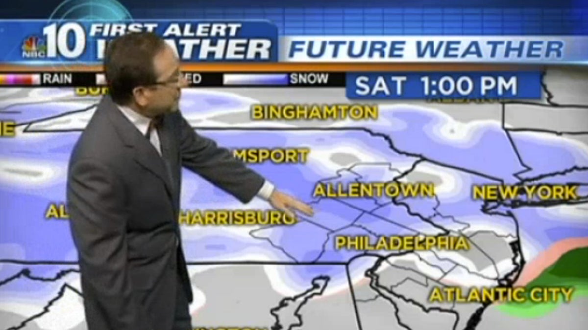
Forecast: A snowy Saturday, and then….

NBC10’s chief meteorologist Glenn “Hurricane” Schwartz says to expect some snow accumulation Saturday. Then, the weather models don’t paint a definitive picture.
As we brace for another snow event this weekend, some people saw a quick flash of flurries that left up to 1 inch of snow Thursday morning as the coldest air yet closed in on the Philadelphia region.
A quick-moving burst of snow left 1 inch on the ground in Quakertown, Bucks County, about an inch in Allentown, Lehigh County, 1/2 an inch in Sellersville, Bucks County, and 1/5 of an inch in Spring Mount, Montgomery County, according to the national weather service. NBC10 cameras also captured snow in Glenside, Northeast Philly and Mercer County, N.J.
The storm caused icy commutes for drivers and some minor accidents.
There is likely more snow to come. We are looking toward another weather system that could bring even more winter weather to the region this weekend.
The system should arrive from the west Saturday morning. NBC10 First Alert Weather chief meteorologist Glenn “Hurricane” Schwartz said that with a deep freeze Friday night any moisture that arrives Saturday should begin as snow.
The storm doesn’t appear to be very well organized but it should still bring snow to most of the area including Delaware and South Jersey, according to the NBC10 First Alert Weather team.
As the storm approaches Schwartz says it appears the storm should be more snow than rain but that it’s still possible for a wintry mix.
Here is the preliminary storm time line:
– Saturday 8 a.m. to noon – snow develops as temps hover around 30
– Noon to 6 p.m. – snow with a wintry mix to the south and east as temps get up to around the freezing mark.
– 6 p.m. to midnight – now/ice/rain (depending where you are) as temps push up towards 34
Estimated totals:
In general, early models show more snow to the north and west but exact totals aren’t clear this far out.
Schwartz says in general terms there is a high chance of getting 3 inches or more on the ground by the time the system moves out Sunday for northern Chester, Montgomery and Bucks Counties and points north. Philadelphia, the near suburbs and South Jersey should only see a medium chance of seeing that much snow with a low change of significant snow to further points south.
What to expect:
Some accumulation is likely to occur throughout the morning and into the afternoon, when the Army-Navy Game will be underway at Lincoln Financial Field. But the fast-moving system makes it difficult to predict the total amount of precipitation.
Ahead of the storm expect bitter cold temperatures, which will likely bottom out in the mid-teens Friday. That cold air will cool off the ground enough to cause any moisture that arrives to almost immediately stick to surfaces.
The trick is how quickly temps go up on Saturday. Lows are expected in the mid-20s in Philadelphia Saturday morning and should push into the 30s as the day goes on but how fast and how quick could be the difference-maker between notable accumulation or not.
The best bet is to continue to check back with the NBC10.com Severe Weather Central and the NBC10 First Alert Weather team.
WHYY is your source for fact-based, in-depth journalism and information. As a nonprofit organization, we rely on financial support from readers like you. Please give today.

