Hurricane Matthew: It’s looking much better for New Jersey

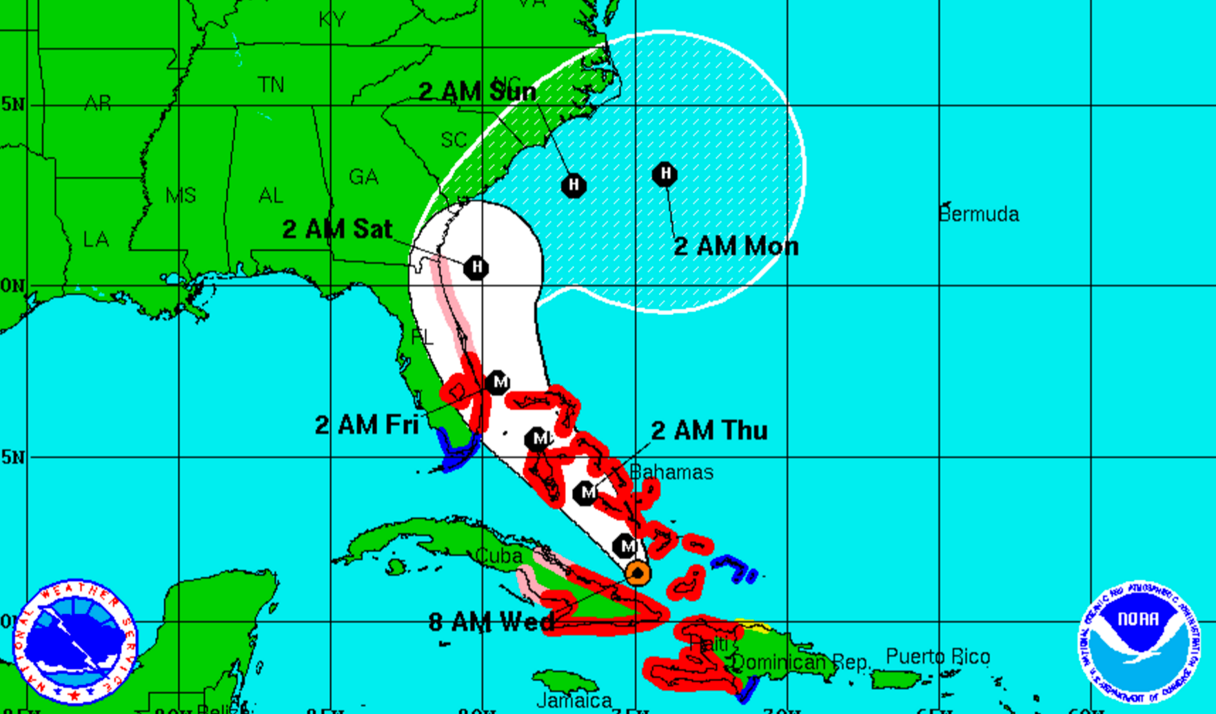
The 8 a.m. Matthew forecast track from the National Hurricane Center.
Hurricane Matthew remains a powerful storm this morning but is unlikely to have any direct impacts on New Jersey or even the nearby states.
As of 8 a.m., Matthew is packing 115 mile per hour winds and heading toward the central and northwestern Bahamas. The forecast then takes the cyclone toward Florida as a major hurricane, possibly making landfall by Friday morning and then tracking up the state’s coast.
The forecast then takes Matthew along at least the Georgia and South Carolina coasts by Saturday night before hooking offshore by early Monday. From there, the forecast is less known, with the cyclone possibly looping around back toward Florida after moving through the Bahamas again.
The National Weather Service office in New York, New York now says the agreement between two major models, the GFS and ECMWF, “is remarkable.”
“Such a scenario would spare the region of any significant impacts outside of rough seas and possibly dangerous rip currents,” the latest forecast discussion from the NWS office said.
The National Hurricane Center says the global models have been trending toward a solution “in which the trough is not deep enough to completely lift Matthew northeastward,” meaning that the atmospheric feature can’t capture the cyclone and pull it.
But the National Weather Service is still not completely confident about the current forecast track.
According to the latest forecast discussion from the National Weather Service office in Mount Holly, how an approaching cold front on Saturday interacts with the trough “will play an important role in the ultimate track of Matthew. The latest guidance has the front/trough not picking up the system.”
“Ultimately if this track is correct, there may be few if any impacts at all. However, with the system lurking in the Atlantic, it needs to be watched for potential impacts down the road,” the discussion said.
The rip current and tidal flooding potential also require monitoring should Matthew track closer than the current forecast suggests.
As for weekend weather, the local National Weather Service office says there’s a shower chance on Saturday due to the approaching cold front, followed by high pressure building in that “will bring us nice weather and help control the motion of Matthew.” The current forecast for Sunday calls for mostly sunny and breezy conditions.
WHYY is your source for fact-based, in-depth journalism and information. As a nonprofit organization, we rely on financial support from readers like you. Please give today.

