

New Jersey air monitoring project measures toxic air pollution data on Camden streets
The mobile air monitoring project aims to identify hot spots of pollution in four overburdened communities in New Jersey, including Camden.
Listen 1:08

A white van drives through Camden as part of a mobile air monitoring project in New Jersey. (Courtesy of the New Jersey Department of Environmental Protection)
From Philly and the Pa. suburbs to South Jersey and Delaware, what would you like WHYY News to cover? Let us know!
For two weeks in March, a white van drove a circuitous route through Camden, past homes, schools, gas stations and industrial facilities.
As it wound through city streets, special sensors attached to the van measured levels of pollutants in the air that come from vehicle traffic and some industrial activities.
The drive was part of a statewide mobile air monitoring project the New Jersey Department of Environmental Protection plans to conduct over the next two years. The goal is to identify hotspots of air pollution in four communities the state classifies as overburdened by environmental and public health stressors.
“It will give us a picture, a detailed picture, that we don’t know [yet] of what these pollutants are actually doing at the local level,” said Jeff Cantor, data manager at DEP’s Bureau of Air Monitoring.
The state is gathering air quality data in Elizabeth and Newark’s Ironbound and South Ward neighborhoods, as well as along the Camden waterfront, which is home to several industrial operations including EMR, a scrap metal recycler that the state sued early this year over repeated fires.
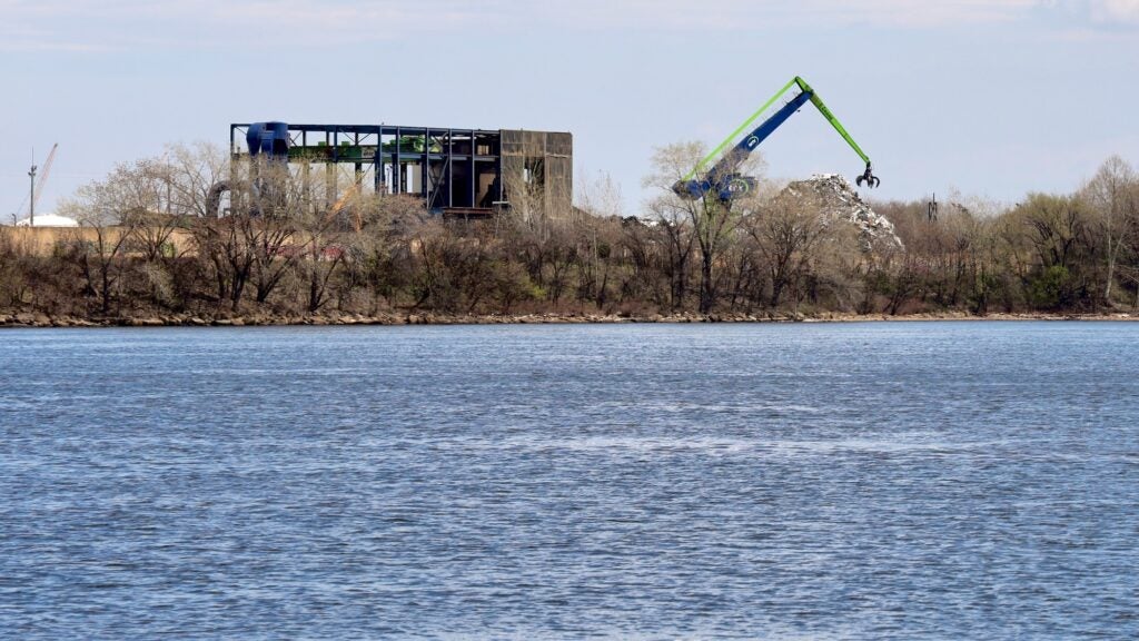
Measuring toxic air pollutants along Camden’s waterfront
The instruments attached to the van measure planet-warming greenhouse gases, particulate matter and other commonly monitored pollutants that can exacerbate conditions like asthma. The sensors can also pick up several families of toxic air pollutants, including cancer-causing benzene, which comes from vehicle exhaust, formaldehyde, which can be found in building materials, paints and fertilizers, and acetonitrile, which is used to make pharmaceuticals and lithium batteries.
DEP says it is focusing on air toxics because they can cause birth defects, cancer or lung irritation.
Cantor said air toxics tend to break down quickly in the air, so data from an existing stationary air monitor located at the Camden County Municipal Utilities Authority may not reflect concentrations on nearby residential streets.
The van’s data collection route passes by several industrial facilities in Camden, including EMR’s shredder, pier facilities and My Auto Store site, the Balzano Marine Terminal, the sewage treatment plant, a Georgia-Pacific Gypsum facility, a natural gas-fired power plant, and Reworld’s waste incinerator. It also winds into residential neighborhoods and passes Cooper University Hospital, the Adventure Aquarium and several schools including the Sacred Heart School in the Waterfront South neighborhood.
To design the route, DEP sought input from community organizations, including the Center for Environmental Transformation. Officials also considered the location of permitted facilities and odor complaints from the past two years that described the smell of sewage, chemicals, burning plastic and metals in Camden.
Related Content

New Jersey sues Camden scrapyard operator EMR over neighborhood impact
Attorney General Matt Platkin filed the suit nearly a year after a major blaze at the Camden scrapyard.
6 months ago
Listen 0:58How the mobile air monitoring data will be used
The mobile air monitoring results could help government officials craft limits for toxic air pollutants in the future, Cantor said.
“The data we’re collecting here may help us — the regulatory community as a whole, not just New Jersey DEP, but our counterparts in other states, U.S. [Environmental Protection Agency], etc. — to better understand what the levels of these chemicals really are and then decide how best to possibly regulate them,” Cantor said.
But the state does not plan to use the data to take enforcement actions against specific industrial facilities. Although the data is being collected on the doorstep of several sites that release air pollution and includes wind speed and direction, it will be difficult for state officials to definitively say where the pollution is coming from, Cantor said.
“I know that frustrates the public, because they can see this stuff and they can smell it,” he said. “But to make sure we’re doing the process correctly, we need a predefined and agreed-upon process of, this is how you take your measurements, this is the level you’re looking for and this is how you use the science to show that it came from that source. So, the short answer is no, we will not be able to do that.”
Portia Simmons, a homeowner in Camden’s Waterfront South neighborhood and board member at the Center for Environmental Transformation, has lived through several fires at the nearby EMR facilities. She sees the mobile air monitoring project as a start at improving environmental conditions in the neighborhood.
“I don’t know that I’ll learn anything [from the data], because I’m living it,” Simmons said. “I’m breathing it, you know, I’m experiencing it. My hope is that the data will inform the powers that be that can make change.”
Simmons hopes the results drive EMR to provide permanent air monitoring devices in the nearby communities to alert residents within 5 miles of EMR’s facilities to air quality emergencies. She also wants to see air-filtration systems installed at schools and nonprofits that serve children and elders in Waterfront South.
EMR did not respond to a request for comment.
How to access the data
DEP plans to collect and release data four times during the two-year project. The first publication of data will likely happen by this summer, Cantor said, using results from the monitoring conducted this spring.
These results will be available on DEP’s website.
DEP plans to publish a final report in late 2027 or early 2028.
Get daily updates from WHYY News!
WHYY is your source for fact-based, in-depth journalism and information. As a nonprofit organization, we rely on financial support from readers like you. Please give today.
Part of the series


In the AI era, New Jersey relies on humans and a 1911 invention to spot wildfires
Perched 100 feet above the Pine Barrens, a man in a tower uses a century-old system to stop fire in its tracks.
1 month ago
Listen 6:34
Volunteers collect over 125,000 of pieces of plastic waste from New Jersey beaches
In 2025, 83% of the trash collected from New Jersey’s beaches were made from plastic.
3 months ago
Listen 1:11
New Jersey is investing $11 million to restore salt marshes, including Scotch Bonnet Island
Rising seas are drowning New Jersey wetlands. A new round of state climate funding aims to make them more resilient.
6 months ago