Afternoon weather update: Showers, storms possible later, but worst is over

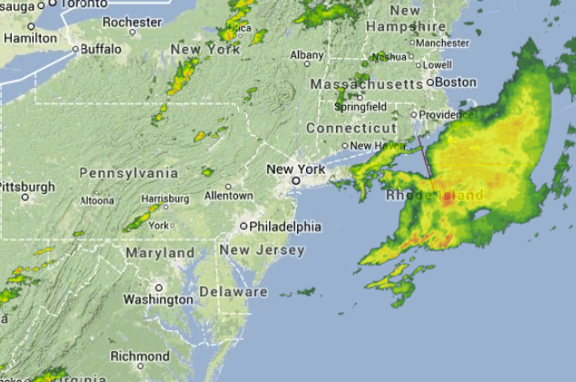
3:30 p.m. radar image, depicting this morning's storms out to sea and a few showers and storms ahead of a cold front in PA. (Image: Weather Underground)
After a wild morning of severe storms in parts of New Jersey that flooded roadways, toppled trees, possibly spawned a tornado, and resulted in a dramatic water rescue of a mother and child, the remainder of the day looks much more settled.
The sun has broken out throughout New Jersey, but isolated showers and thunderstorms are possible in advance of a cold front passage later today.
The National Weather Service advises that the cold front will pass from west to east, arriving in western areas during the early evening, crossing New Jersey, and then heading out to sea around midnight.
Despite the chance of some precipitation as the front moves through, what’s clear is that the worst is over.
Clearing overnight, with the wind shifting to the northwest, drying everything out.
Courtesy of high pressure, Wednesday through Friday will feature spectacular late summer weather: low humidity, an abundance of sunshine, and temperatures in the upper 70s.
Still decent for the weekend, but some clouds around and a shower, particulary in South Jersey, cannot be ruled out Saturday night into Sunday. Stay tuned.
WHYY is your source for fact-based, in-depth journalism and information. As a nonprofit organization, we rely on financial support from readers like you. Please give today.

