70s likely for Christmas Eve

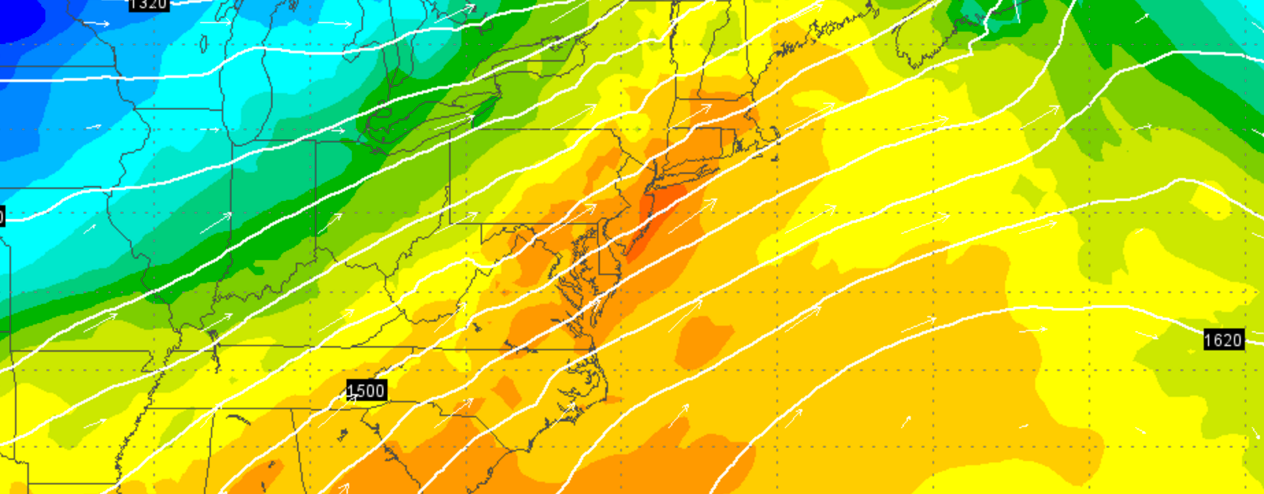
Warm air surging northward during the afternoon of Christmas Eve as depicted on the EURO model. (Image: Weather Underground)
Warm air will surge up from the south this week, allowing temperatures to peak in the lower to middle 70s on Christmas Eve before dipping slightly on Christmas, forcing Santa Claus to travel along the Eastern seaboard wearing a bathing suit instead of his typical heavy garb.
Temperatures are above average today, increasing steadily during the week. But rounds of showers and increasing humidity will accompany the mild conditions tomorrow, Wednesday, and possibly during the early hours on Christmas Eve.
After a southerly dip in the jet stream over this past weekend, allowing for cold air to filter into the region, the jet stream is now moving north, according to the National Weather Service.
The clockwise flow from a high pressure system in the Atlantic Ocean is allowing the southerly flow — warm and humid — to pump northward.
High temperatures will peak in the lower to middle 70s on Christmas Eve, dropping to around 60 degrees for Christmas following a cold front passage during the early morning hours — still around 15 degrees above normal. Mostly sunny skies will prevail on Christmas.
Highs will remain in the middle to upper 50s during the weekend. Unsettled conditions are possible.
WHYY is your source for fact-based, in-depth journalism and information. As a nonprofit organization, we rely on financial support from readers like you. Please give today.

