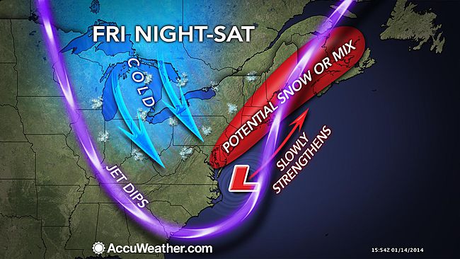
Wintry weather possible Friday night into early Saturday

Forecasters are monitoring the chance of wintry weather Friday night into early Saturday, although uncertainty reigns.
The snow threat is just one in a series of storms that could move through the area into next week.
“These storms, known as Alberta Clippers, will generally be weak and fast-moving, so that they will fail to bring much precipitation,” according to a report by AccuWeather.com Expert Senior Meteorologist Alex Sosnowski.
But for the early weekend possibility, the jury’s out on how the storm will behave.
AccuWeather.com is forecasting the likelihood of a period of snow for part of the Mid-Atlantic, with the possibility of a rain and snow mixture along the coast.
The National Weather Service office in Mount Holly, NJ notes in its latest forecast discussion that while “the spread in the solutions is still fairly large,” the system could potentially deliver “snow of a somewhat more significant nature.”
But there is more certainty regarding waves of colder air impacting the region through next week.
“The pattern will favor frequent temperature changes from one day to the next,” said AccuWeather.com Chief Meteorologist Elliot Abrams.
WHYY is your source for fact-based, in-depth journalism and information. As a nonprofit organization, we rely on financial support from readers like you. Please give today.

