Smoke on the water: Sea smoke season begins in N.J.
The early Jersey Shore beach birds were greeted by a visually stunning scene Wednesday morning.

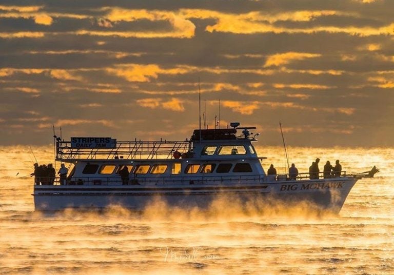
A fishing boat is enveloped by sea smoke off Spring Lake, New Jersey on Saturday, November 9. (Image courtesy of Mike Casella)
The early Jersey Shore beach birds were greeted by a visually stunning scene Wednesday morning.
In Monmouth County’s Spring Lake, the ocean temperature at sunrise was in the lower 50s while the air temperature registered a frigid 22 degrees.
That’s where photographer Mike Casella captured a boater navigating through “sea smoke,” a phenomenon that only occurs during sharp air and water temperature differentials.
Delaware Sea Grant explains:
These smoky-looking plumes rising from the ocean surface can be seen when still cold air overruns the warm moist air at the sea surface. Because the surface air is so much warmer than the cold air above it, the moisture in the rising warm air quickly condenses into small water droplets (like seeing your breath on a cold day).
This phenomenon is often observed in colder climates – for example in the Arctic, Antarctic, and along the coast of Maine. Autumn is the season when sea smoke is most typically observed, as cold blasts of polar air masses blow over warm Atlantic waters.
The brutal Arctic cold front that moved through New Jersey yesterday reached as far as the Florida Panhandle, creating a dramatic sea smoke scene in Pensacola.
Sea smoke over the Gulf of Mexico as the very cold air moves over warmer water. It has been 663 days (Jan. 19th, 2018) since Pensacola has recorded a temperature this low as we sit at a chilly 30 degrees! #NWFL #flwx pic.twitter.com/bN3kLjgDth
— Kaitlin Wright (@wxkaitlin) November 13, 2019
WHYY is your source for fact-based, in-depth journalism and information. As a nonprofit organization, we rely on financial support from readers like you. Please give today.


