Smoke on the water: Sea smoke returns

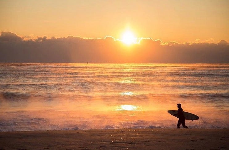
A surfer gazes at sea smoke over the northern Jersey Shore waters around sunrise yesterday. (Photo: Michael Guccione as tagged #JSHN on Instagram)
Early morning surfers yesterday at the Jersey Shore were greeted by a visually stunning scene.
In Atlantic City, the ocean temperature at the time was around 40 degrees while the air was much colder.
The sharp temperature difference was similar further north up the coast, where Michael Guccione shot the above image from a snowy beach and posted on Instagram (@michaelguccionephoto).
The result? “Sea smoke,” a phenomenon that only occurs during extreme cold.
Delaware Sea Grant explains:
These smoky-looking plumes rising from the ocean surface can be seen when still cold air overruns the warm moist air at the sea surface. Because the surface air is so much warmer than the cold air above it, the moisture in the rising warm air quickly condenses into small water droplets (like seeing your breath on a cold day). This phenomenon is often observed in colder climates – for example in the Arctic, Antarctic, and along the coast of Maine. Autumn is the season when sea smoke is most typically observed, as cold blasts of polar air masses blow over warm Atlantic waters.
NewsWorks has reported on sea smoke at the Jersey Shore around the same time each year since 2014.
So if you’re looking for warmth, go surfing.
WHYY is your source for fact-based, in-depth journalism and information. As a nonprofit organization, we rely on financial support from readers like you. Please give today.

