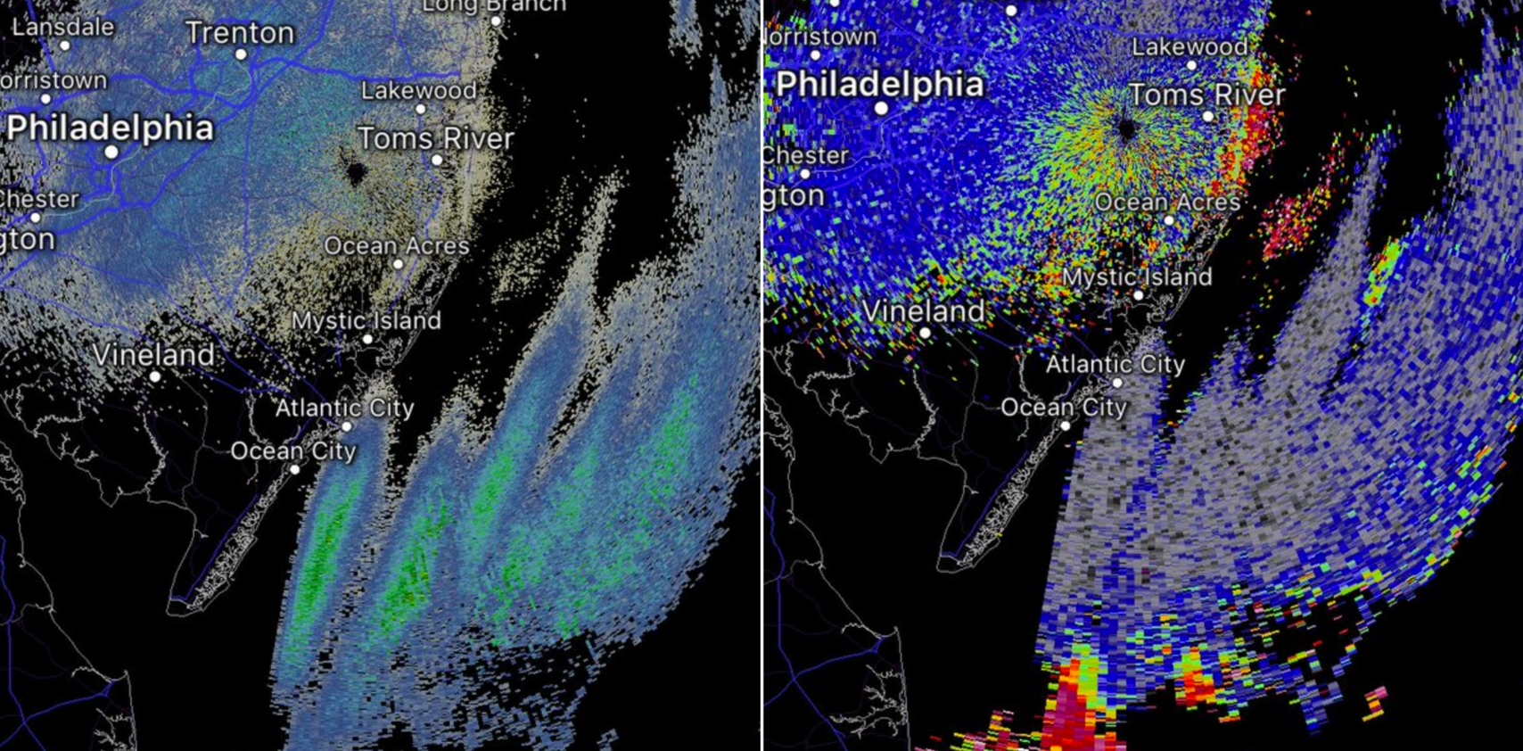
Radar detects military “chaff” off N.J. coast

(Radar imagery as captured by @nuagesdorage via Twitter)
You learn something new everyday.
And for today, this is likely no exception. Here’s something for dinner table discussion.
You may have been looking at your favorite radar app around 9:15 last night and noticed a large cluster of rain apparently moving toward the coastline.
But it wasn’t rain.
Although it appeared somewhat similar to migrating birds, they’re all back from their wintering grounds.
So what was it?
Military chaff, according to the National Weather Service office in New York, New York.
“Chaff consists of small fibers that reflect radar signals when dispensed in large quantities from an aircraft,” the service tweeted. “This is done in military exercises and the purpose is to form a cloud that temporarily hides the aircraft from radar detection.”
It’s a countermeasure intended to confuse an enemy.
The forecasters were able to determine the presence of chaff by examining the correlation coefficient radar mode (on the right in the image above), which indicates that the returns are not produced by a meteorological event.
Radar detected chaff around an area called the “Test Track,” which parallels the Delmarva Peninsula. It’s where the military routinely conducts supersonic flights.
It’s the same location from where sonic booms were generated earlier this year.
WHYY is your source for fact-based, in-depth journalism and information. As a nonprofit organization, we rely on financial support from readers like you. Please give today.

