Plan for several hours of tidal flooding Tuesday

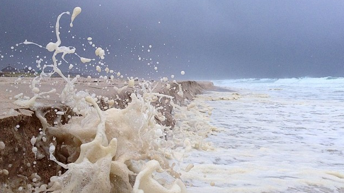
South Seaside Park in August 2014. (Photo: Justin Auciello/JSHN)
The Jersey Shore is bracing for a round of tidal flooding Tuesday morning as a potent coastal storm is set to track offshore.
A Coastal Flood Warning is in effect from 7 a.m. until 3 p.m. Tuesday.
An onshore flow is set to develop today, becoming stronger through tomorrow with increasing winds. Gusts up to 60 miles per hour are possible at the coast, with progressively less wind inland. Widespread power outages are possible, so be prepared should you lose power.
Moderate coastal flooding is likely at the Shore for several hours around the time of the Tuesday morning high tide, according to the National Weather Service.
High tide along the oceanfront occurs between 9:15 and 10:15 a.m., occurring later on the back bays and Raritan and Delaware bays. The storm will likely be a relatively quick mover, which is great news for coastal communities, but lingering tidal flooding is possible during the Tuesday evening high tide.
The surge will be around two to three feet above the astronomical tide. Waves will be 10 to 15 feet in the ocean.
Numerous roadways are expected to flood, with many becoming impassable, Minor to moderate property damage is possible in low-lying areas, and significant beach erosion is likely.
In a late morning forecast discussion, the National Weather Service office in Mount Holly is considering the possibility of marginal major tidal flooding.
In related storm news, precipitation is also a concern. A Blizzard Warning (implying low visibility) is up for Monmouth and Ocean counties, while a Winter Weather Advisory covers coastal Atlantic and Cape May counties.
The forecast calls for snow to arrive Monday evening, becoming heavy overnight into the Tuesday morning hours. It is then expected to taper off late in the afternoon.
The National Weather Service says there are “many complications” that can occur at the Shore, with sleet and rain possibly mixing in in the northern half and rain in the southern half.
The highest accumulations are expected to the north and west of the New Jersey Turnpike and inland from the coastal communities.
At the Shore, the service’s forecasters are calling for the most snow accumulations in northwestern Monmouth County, with progressively less amounts toward Cape May. The forecast maps are subject to change this afternoon as a different track with warmer air and more mixing will cut down substantially on accumulation totals.
As always, slight shifts in the storm track will have significant consequences. All numbers are subject to change as they’re simply best guesses based on the latest data.
With blowing snow and low visibility, the National Weather Service is not recommending traveling tomorrow.
Stay tuned here and Jersey Shore Hurricane News for updates.
WHYY is your source for fact-based, in-depth journalism and information. As a nonprofit organization, we rely on financial support from readers like you. Please give today.

