

National Weather Service downgrades threat to New Jersey from Hurricane Joaquin


This satellite image taken Thursday, Oct. 1, 2015 shows Hurricane Joaquin over the Bahamas . (NOAA via AP)
The National Weather Service said the threat of major impacts from Hurricane Joaquin has lessened for New Jersey.
The latest forecasting models on Thursday predicted Joaquin would stay further east off-shore. This would reduce the amount of rain and wind for New Jersey, Pennsylvania and Delaware if the current models hold.
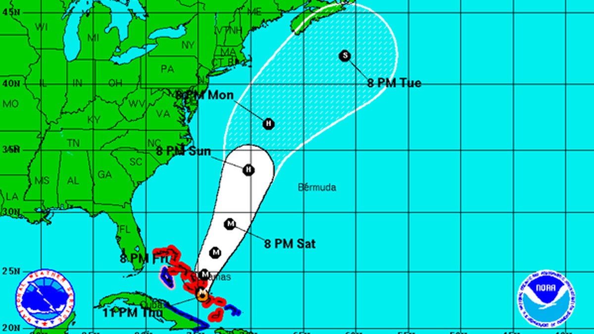
Joaquin was a Category 4 hurricane late Thursday centered about 20 miles southeast of Clarence Town, Long Island, Bahamas. It will likely head north over the next couple of days and likely pass to the East of Delaware and New Jersey on Monday.
A separate storm that is moving into our region now is expected to bring 1 to 3 inches of rain through Saturday morning.
Moderate to major coastal flooding is expected on Friday and Saturday along the Atlantic Coasts of Delaware and New Jersey, as well as the lower Delaware Bay. Minor to moderate coastal flooding is possible on the upper Delaware Bay.
Associated Press contributed to this report.
WHYY is your source for fact-based, in-depth journalism and information. As a nonprofit organization, we rely on financial support from readers like you. Please give today.

Tens of thousands walk the Benjamin Franklin Bridge to celebrate its 100th birthday
While walkers of all ages took in the views, speakers and elected officials touted the bridge’s vital role in the region’s economy.
6 hours ago

If left untreated, symptoms can last anywhere between a few days and a month or longer.
2 days ago

EMR can restart its fire-prone Camden scrapyard after it ensures sprinkler system works, judge says
The judge’s order comes after City Council rejected a settlement with EMR that would have allowed the site to reopen with conditions.
2 days ago