Gradual clearing today; dry this weekend

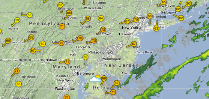
Current area conditions as of 4:14 p.m. today. (Image: weatherunderground.com)
A cold front extends through eastern Pennsylvania late this afternoon and will continue to head east during the remainder of the day.
Showers with some brief winds gusts passed through the New Jersey region earlier today, but the precipitation threat is now is very limited, according to the latest National Weather Service forecast.
Sunshine is breaking through the clouds in many areas throughout New Jersey, particularly in the central and northern portions of the state. Mainly cloudly skies remain over portions of South Jersey and the Delmarva region. It’s still rather muggy.
But much drier air moves in overnight.
Saturday will be partly cloudy and comfortable, with temperatures in the middle 60s and a light northwest wind. While even more sunshine is expected on Sunday, it will be much cooler — daytime highs in the low 50s — with a brisk northwest wind, so it’ll feel like temperatures are in the 40s.
WHYY is your source for fact-based, in-depth journalism and information. As a nonprofit organization, we rely on financial support from readers like you. Please give today.

