Forecasters monitoring tropical disturbance off South Carolina

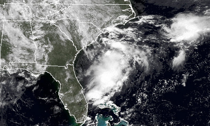
NOAA satellite imagery of the area of disorganized showers and thunderstorms off the coast of South Carolina Saturday morning.
Forecasters at the National Hurricane Center are monitoring an area of disorganized showers and thunderstorms off the coast of South Carolina.
Dubbed Invest 91L, environmental conditions are conducive for “gradual development of this system,” a National Hurricane Center Tropical Weather Outlook advises.
‘Water vapor satellite loops showed that the atmosphere was moderately moist off the Southeast U.S. coast, and dry air should not be a significant impediment to development. The Hurricane Hunters are on call to investigate 91L on Sunday afternoon,” writes Weather Underground forecaster Dr. Jeff Masters in a blog post.
Masters writes that while forecast models are currently offering divergent solutions, he favors a “more northeasterly motion” of the system over the next five days.
The Atlantic hurricane season began on June 1 and ends on November 30. No tropical systems have formed as of late June.
The season peaks in September, and 80 percent of named storms between 1981 and 2010 have formed between August and October, according to The Weather Channel.
For maps and additional information, visit Weather Underground’s tropical activity page.
WHYY is your source for fact-based, in-depth journalism and information. As a nonprofit organization, we rely on financial support from readers like you. Please give today.

