Forecasters expect little to no snow at the Jersey Shore

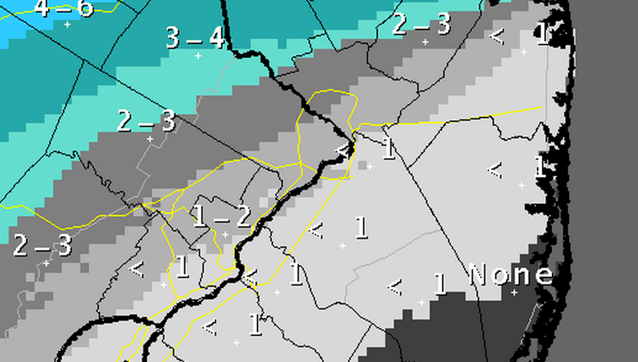
Snowfall accumulation map issued by the National Weather Service in Mount Holly, NJ Saturday afternoon.
The Jersey Shore will see little to no snow from a system that will move through the region Sunday night into Monday, forecasters say.
For the second day, forecast models continue with a northern shift, pushing snow that was previously in the forecast for at least half of the shore further north.
The current National Weather Service forecast calls for snow in the northern half of the shore, ranging from two to three inches in northwestern Monmouth County to less than an inch in central Ocean County. There is no snow in the forecast to the south.
Due to warmer air at the surface and just above it, expect a mix of rain, snow, and sleet at the shore before midnight, transitioning to rain, according to the latest NOAA forecast. By Monday, rain continues during the morning for most of the shore, transitioning to a mix of rain and snow during the early afternoon and changing to snow after 4 p.m.
The farther north you live at the shore, the more likely you will see frozen precipitation, although amounts will be light.
Anyone traveling north into Middlesex County and beyond should monitor conditions as both snow and freezing rain are in the forecast (click here for northeastern NJ and NYC).
WHYY is your source for fact-based, in-depth journalism and information. As a nonprofit organization, we rely on financial support from readers like you. Please give today.

