

First major winter storm for New Jersey to create dangerous driving conditions


FILE PHOTO (AP Photo/Nati Harnik))
After an incredibly warm and dry December, New Jersey is going to get a blast of winter this weekend.
For most of South and Central New Jersey it could bring 6 to 18 inches of snow with strong winds. The combination will create near blizzard-like driving conditions and below-zero wind chill temperatures.
For New Jersey’s coastal towns, it’s going to be whole different problem. Moderate coastal flooding is possible for all points south of Monmouth to Cape May counties and along the Delaware Bay in Cumberland County. The storm will arrive on a full moon creating very high tidal waters.
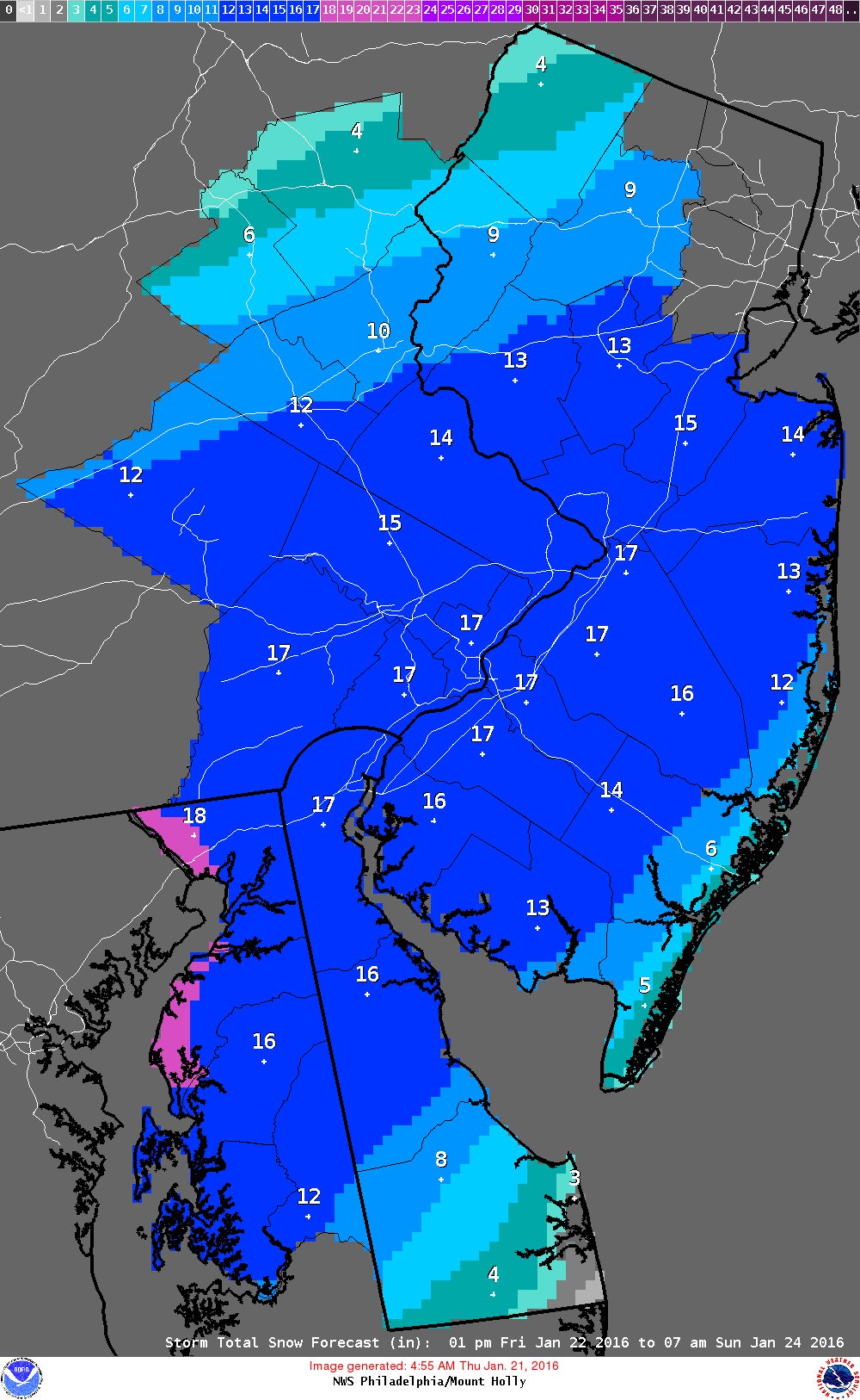
A Blizzard Watch has been issued for Southeastern Pennsylvania, Southwestern New Jersey, Northern Delaware and Maryland’s Upper Eastern Shore. Starting on Saturday the winds in Philadelphia and the region will be 20-30 mph with occasional gusts up to 40 mph. This could create visibility less than one-quarter of a mile for drivers Saturday and Sunday.
A Coastal Flood Watch has been issued for the New Jersey counties of Ocean, Southeastern Burlington, Atlantic, Cape May and Cumberland counties.
High tide schedule
Seaside Heights – Saturday, 6:30 a.m., 6:58 p.m. and Sunday, 7:14 a.m
Atlantic City – Saturday, 6:43 a.m., 7:09 p.m. and Sunday, 7:26 a.m
Cape May – Saturday 7:17 a.m., 7:43 p.m. and Sunday, 8 a.m.
WHYY is your source for fact-based, in-depth journalism and information. As a nonprofit organization, we rely on financial support from readers like you. Please give today.

If left untreated, symptoms can last anywhere between a few days and a month or longer.
1 day ago

EMR can restart its fire-prone Camden scrapyard after it ensures sprinkler system works, judge says
The judge’s order comes after City Council rejected a settlement with EMR that would have allowed the site to reopen with conditions.
2 days ago

July 9 - July 12: K.C. and the Sunshine Band in Delaware, Blobfest in the Philly burbs and Dave Matthews Band in South Jersey are among weekend event highlights.
2 days ago
Listen 5:39