CyclePhilly app giving transportation planners a handle on region’s bikers
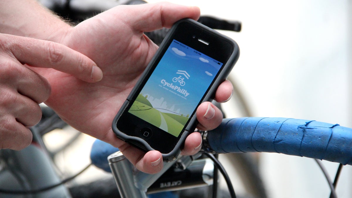
Philadelphia bicyclists are encouraged to download an app that tracks their movements. The data will be used to plan new bike routes in the city. (Emma Lee/WHYY)
It’s been two months since the launch of CyclePhilly, the mobile application that collects rider data in hopes of improving regional bike routes. Early results indicate a success.
The application has already logged more than 5,000 trips and has about 150 users, and researchers from the Delaware Valley Regional Planning Commission are ready to start crunching numbers and pitching projects.
“This is a big chunk of data that we’ll be able to sink our teeth into,” said Greg Krykewycz, manager of the commission’s Office of Transit, Bicycle and Pedestrian Planning.
“This is the right project at the right time to help us capture that data so that we can make even better project decisions,” he said.
Philadelphia bike culture is growing. The terrain is ideal — it’s flat, there are bike paths and an interconnected street grid; as a result, the city has one of the highest percentages of commuters who bike to work in the entire U.S.
It was with this in mind that Code for Philly created the user-friendly application. Bikers who download CyclePhilly simply hit “start” at the beginning of their ride, “finish” at the end their ride, and then indicate the purpose of their ride.
Some of the initial results show that about three-quarters of logged trips are either into or from Center City, and just over half are commuters. The average trip length was about four miles.
More importantly, the DVRPC is able to see the exact route taken – a vast improvement over the bike traffic counters or census data used in the past.
“Part of what the data tells us is origins and destinations,” said Krykewycz. “If they’re riding in a very roundabout way, then it tells us maybe there’s a market. Some cyclists are hearty enough to make that roundabout. But there might be other people starting in the same place and going to the same place that, if we made a better connection, people would take advantage of it.”
A better experience for riders might involve adding a bike lane to a busy street or, in some cases, adding a whole new path.
This is not the first time mobile phones have been involved in urban transportation planning.
Looking at places bikers avoid
In 2011, Jennifer Duthie, a research engineer with the University of Texas-Austin Center for Transportation Research, used a mobile application similar to CyclePhilly to analyze about 5,000 bike trips in the Austin area. Her results were published in 2012.
“One of the things we found most powerful was to look for what routes, or what parts of the city, people were avoiding,” said Duthie.
“If we just focused on which routes people were taking, we might not be focusing on the routes they really want to take, maybe there’s a reason for that. That’s what’s really helped, at least in the city of Austin — we could highlight those places that people were avoiding and use that to plan where bike infrastructure could really give the biggest bang for the buck.”
One region of Philadelphia that could benefit from improved bike statistics is the suburbs, according to John Boyle, research director for the Bicycle Coalition of Greater Philadelphia, which works closely with DVRPC on bike transit planning.
Boyle said that census data doesn’t account for cyclists who ride to transit stations. Data from his own neighborhood indicated zero bike commuters, even though he and many of his neighbors ride their bikes to the local train every day.
“There has been planning for improving bicycling [in the suburbs] but there is almost no data that supports these plans,” said Boyle.”We don’t know where people are bicycling, just that people are.”
Now data is showing that paths including the Schuylkill River Trail and Bicyclists Baltimore Pike in Delaware County are used most often — not surprising because of how popular these routes are.
Troubleshooters on wheels
Tougher for regional planners to figure out is if adding a new route would be worth it. In other words, data may show that cyclists take a certain popular route, but only because that’s the only route available.
“That’s the nature of transportation planning,” said Krykewycz. “There’s no magic bullet to look at what this particular piece of data means. There’s no linear way to say five people taking this route now means there’s a latent demand that 50 people will use it.”
For now, the DVRPC is focused on tracking the data and making improvements where it can until more infromation comes in. One novel feature of the CyclePhilly app is the ability of users to upload notes and photos of problems and suggestions along their route — a feature the developers have noticed is popular.
Thanks to the growing popularity of the biking community, more funding for bike transit projects is available, according to Krykewycz.
“The money is growing because there’s more and more people asking for it, more and more people interested in biking and walking and taking transit,” said Krykewycz. “That’s why projects like CyclePhilly are really timely, because we need this data right now.”
WHYY is your source for fact-based, in-depth journalism and information. As a nonprofit organization, we rely on financial support from readers like you. Please give today.
