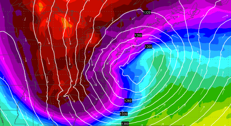
Cold wave on the horizon

The second round of Arctic air arriving early Sunday morning, as depicted on the European forecast model. (Image: Weather Underground)
Prime cuddling weather is arriving just in time for Valentine’s Day.
Thursday marks the beginning of a prolonged Arctic outbreak in New Jersey, featuring some of the coldest air of the season, according to Gary Szatkowski, meteorologist-in-charge of the National Weather Service office in Mount Holly, NJ.
And if that’s not enough, periods of strong northwest winds from Canada will flow through the region, resulting in sub-zero wind chills, the forecaster says.
“The prolonged cold will be a threat to both life and property. People will need to be prepared for the very cold wind chills,” Szatkowski warns. “And the prolonged cold may result in problems with water lines as the ground freezes to a considerable depth.”
At the Shore, temperatures will be in the teens Friday morning, the first day of the cold wave, but a biting wind will make it feel much colder.
After a brief moderation to near 30 degrees on Saturday, a reinforcing blast of cold air arrives during the night, resulting in dangerously low wind chill values Sunday morning.
The numbing cold on Friday and Sunday follows two storm systems that may bring accumulating snow Thursday and Saturday. For coastal areas, NOAA forecasts snow showers on Thursday, but Saturday remains uncertain.
After the weekend, no warm-up is in sight, with the National Weather Service Climate Predication Center forecasting a high probability of below normal temperatures through February 23.
WHYY is your source for fact-based, in-depth journalism and information. As a nonprofit organization, we rely on financial support from readers like you. Please give today.

