Can University City District and Gehl Studio turn eastern University City’s institutional blight into a walkable neighborhood?
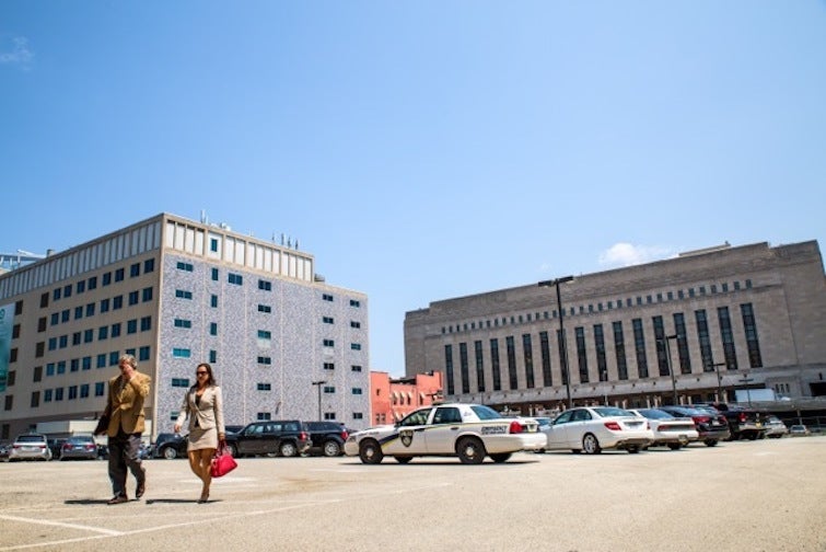
With about 8 million square feet of new development projects announced for eastern University City over the next few years, University City District sees an opportunity to bring the area’s pedestrian landscape down to human-scale, and it has enlisted some top national talent to help in that effort.
Gehl Studio, the American office of Danish urbanism giant Jan Gehl, has been commissioned to conduct a walkability survey and make recommendations for the eastern gateway of University City, bounded by Walnut St., Arch St., 33rd St. and the Schuylkill River.
The Gehl name is politically significant because he is one of the progenitors of the urbanist ideological values that transportation reformers like Janette Sadik-Khan and Gabe Klein have championed in transportation and streets departments in many of our peer cities.
To be fair, the Nutter administration has had some success over the past seven years raising the status of urbanist political values within city departments like the Planning Commission, the Mayor’s Office of Transportation and Utilities, and the Water Department.
And outside of government, business improvement districts and non-profits like University City District, Center City District, and the Community Design Collaborative have been on the front lines of reclaiming public rights-of-way for pedestrians and cyclists.
The effect has been more muted here though, as District City Council members control key land use and streets policy levers, and this Council has kept a heavy foot over the brake for pedestrianization and parking attrition efforts.
The Headhouse District pedestrian plaza proposed for a redundant stretch of E. Passyunk Ave off South Street, the 22nd St bike lane north of Spring Garden, the protected cycle track on Market and JFK, and other traffic calming projects have been delayed or killed outright over Council political objections, and back in 2012, District Council members succeeded in grabbing control of bike lane approvals for new lanes that require reductions in parking or travel lanes. And the ink was barely dry on the new zoning code before some Council members started introducing bills to reinstate minimum parking requirements.
So with the Nutter administration’s political capital on the wane, it’s fallen to private and non-governmental organizations to move the ball forward. The strongest civil society leadership for this agenda currently resides in University City, with UCD’s Prema Gupta and Drexel’s John Fry both intensely interested in tipping the area toward a walkable mixed-use development paradigm. The choice of Gehl Studio can be read as a signal of intent to scale up, rather than scale back, this agenda.
Members of the Gehl team on the University City project previously worked for the now-defunct Rebar – the San Francisco studio best known as the inventors of Park(ing) Day, and for their leadership in parklet design.
UCD worked with Rebar on the Art Place grant for The Porch at 30th Street Station – a former stretch of 34 parallel parking spaces that has since been outfitted with tables, umbrellas, and street seating – so the Gehl team is already familiar with the area. They’ve been visiting recently for an installation project UCD is working on for The Porch involving swings.
“We’re still fleshing it out, but a porch should have a swing right?” says Gupta, “The challenge is the swings have to work with The Porch in its current incarnation, and also as we redesign the Porch.”
Landscape architect Bryan Hanes is working with UCD on a plan to make The Porch more permanent and turn it into more of a park.
That formula – putting something on the ground quickly and (relatively) cheaply to test an idea or prove a concept prior to making permanent changes – has been the key to several UCD success stories like the Woodland Green pedestrian plaza, which will also become permanent.
“The Porch was a huge success, and it’s funny in retrospect because at the time it seemed like such a huge risk,” Gupta said, “Some of the smartest people in Philadelphia told us it was a place where people would never linger – that this is a place for people to move through. And I think that’s the fundamental issue with this area: it has high pedestrian counts, but it’s not walkable.”
While public space interventions can’t change everything (Next City’s Stephen Smith recently blamed the area’s “eds-and-meds monoculture” on excessive use of institutional and industrial zoning) Gupta believes streetscape changes can have an impact by “setting the tone for more walkable, more vibrant university and private development in the area.”
“University City is sort of like an island – there are finite ways to get on or off, and we’re kind of at peak-car right now so I think what’s really interesting to us as an organization is how we can get more people to take transit trips, or bike, or walk to work.”
The early survey work completed thus far by UCD intern Daniel Wolf shows that commuters account for most of the walking trips in this area, and one focus of the Gehl study will be examining in greater detail what the last mile of these commutes looks like.
Which routes do people take once they get off the train or exit the parking garage? Where are the pedestrian crash hot-spots? Where do we see the most jay-walking? With these questions (and many more) answered, they’ll identify “eight to twelve” target areas for walkability improvements.
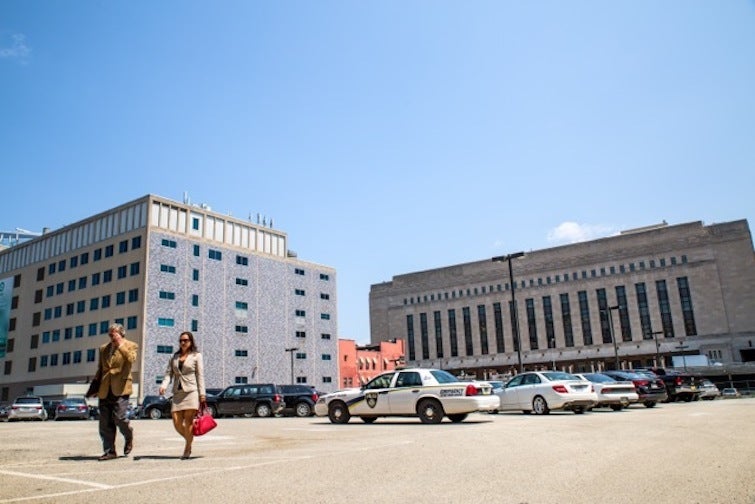
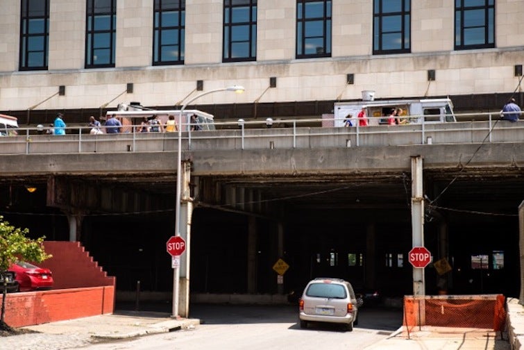
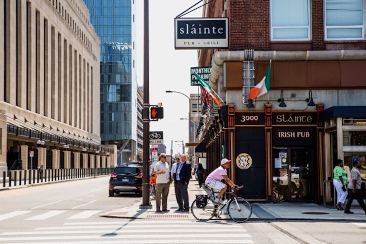
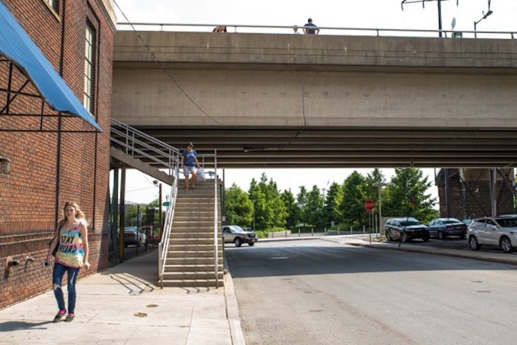
“We’ll also be looking at the visual aspect of walkability,” says Wolf, “the quality of the facades on each side, the number of entrances per block width, transparency measurements – how much you can see people inside of the buildings.”
Wolf provided PlanPhilly with some photos of the area he took while doing the initial survey work, to give readers a sense of what he’s been looking for:
Pedestrian safety will also be a key factor in determining which places are targeted for walkability interventions. University City is a pedestrian crash hot spot, with 47 pedestrians struck by cars in the study area between 2008 and 2012. The main culprits are the wider east-west streets – Walnut, Chestnut, and Market – with the stretch of Market St. between the Schuylkill and 33rd St. alone responsible for 24 of those crashes, counting the intersecting street segments.
Click on the street segments below to see how many pedestrian crashes happened there between 2008 and 2012:
WHYY is your source for fact-based, in-depth journalism and information. As a nonprofit organization, we rely on financial support from readers like you. Please give today.


