Brief springlike warm-up on the way

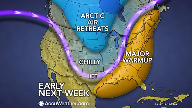
Forecasters say that the jet stream will retreat to our north, allowing warm air from the south to surge into the region by Sunday. (Image: AccuWeather.com)
After days of January-like weather, a brief surge of springlike air arrives on Sunday.
Forecasters say that the jet stream will retreat to our north, allowing warm air from the south to flow into the region.
At the Jersey Shore, high temperatures will reach the upper 50s on Sunday and the lower 60s on Monday, according to the latest NOAA forecast.
Rain will accompany the mild surge, overspreading the area from south to north Sunday afternoon into the evening hours. A chance of showers will remain for Monday.
The current forecast is trending toward normal temperatures (lower to middle 50s at the shore) for Tuesday, dropping to slightly below normal by Wednesday.
Another cold shot — not as potent as the ongoing chill — arrives for later in the week, according to AccuWeather.com.
WHYY is your source for fact-based, in-depth journalism and information. As a nonprofit organization, we rely on financial support from readers like you. Please give today.

