Arctic blast slowly easing; 50s by the weekend

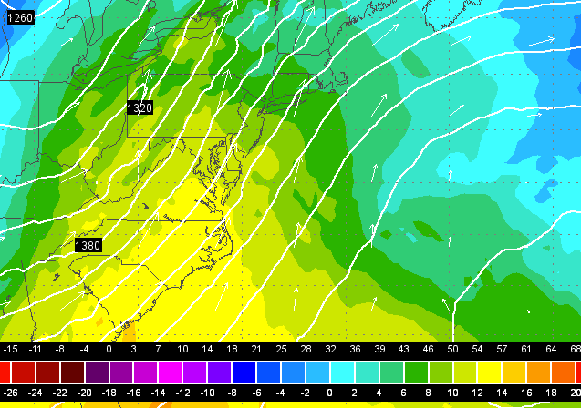
A screenshot from the 0z EURO model run showing warm air streaming into the region Saturday.
The polar vortex is moving on soon.
The surface high pressure system responsible for the dangerously cold weather will move offshore Thursday, according to the National Weather Service office in Mount Holly, NJ.
Even though conditions today are an improvement over yesterday, high temperatures will only rise into the 20s, and the wind chill will remain a factor. We begin to see moderation Thursday, when winds will decrease and high temperatures rise into the 30s, according to NOAA. Then on Friday, the upward temperature trend will take us to the 40s.
After dry conditions for days, moisture arrives late Thursday night into Friday morning when a warm front crosses the air and “could begin as some light snow before milder air arrives before milder air arrives, changing the precipitation to rain,” the National Weather Service advises.
The real “warmth” arrives on Saturday, when a southerly flow delivers mild air to the region, according to the National Weather Service. Daytime highs in the 50s (warmest south) will be well above normal, the service advises. Rain showers are likely Saturday, with improvement for Sunday. The mild weather continues through Sunday and early next week.
But around next weekend, “we can generally expect the colder and active winter pattern we have predominately seen to return,” according to New York Metro Weather meteorologist Doug Simonian.
WHYY is your source for fact-based, in-depth journalism and information. As a nonprofit organization, we rely on financial support from readers like you. Please give today.

