Rover Still Rovin’
Listen 05:08
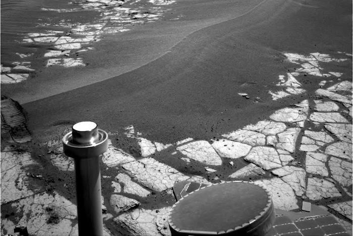
This image was taken with Opportunity's navigation camera of a large dune on the way to Victoria
NASA’s Mars Reconnaissance Orbiter has returned images that clearly show thick layers of water ice just beneath the surface and extending up to 100 meters down in some places. The layers were spotted on exposed cliff faces mostly in the southern hemisphere. Geologists surmise that the ice formed from thin layers of surface frost and snow that later compacted and recrystallized. As the cliff faces are exposed, the water ice sublimates and the dehydrated rocky material crumbles away and falls to the cliff footings, exposing new deposits of previously buried ice. That water is frozen into the Martian soil isn’t news. In 2008, the Phoenix lander scraped the soil surface not far from the Martian north pole and exposed layers of permafrost just centimeters below. Radar scans from orbit also indicate huge glaciers of ice are just 20 m below the surface and cover a third of the Martian surface.
Opportunity Rover has been operating successfully on Mars for 5,000 days – 13.5 years! Originally, the expected mission length was 9 months. It’s covered 28 miles and returned 225,000 pictures. It’s seen it share of dangers; sand traps, steep crater slopes, dust storms, cold, dim Martian winters, equipment failures, and communications issues. Engineers have finessed ways around all of these to send back information extraordinary information and images.
WHYY is your source for fact-based, in-depth journalism and information. As a nonprofit organization, we rely on financial support from readers like you. Please give today.


