Winter won’t let us go: Storm looms for early next week, but uncertainty reigns

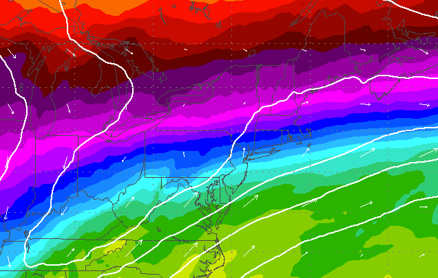
850 mb temperature profile from the early Wednesday EURO forecast model, indicating a range from colder (north) to warmer (south) in the region.
In like a lion?
Courtesy of an active winter pattern, a storm threatens for the late Sunday through early Tuesday period, but forecasters say details are quite unclear.
“Beyond the near record cold this weekend will come the potential for a more significant precipitation event early next week. But the details of the storm system remain quite cloudy — no pun intended — at this point,” said John Homenuk, lead forecaster at New York Metro Weather.
The uncertainty centers around temperatures, which ultimately control precipitation types. Waves of low pressure will ride along a stalled frontal boundary between Sunday and Monday, and “very few” forecast models indicate that the threats “will go quietly into the night,” according to a forecast discussion issued by the National Weather Service office in Mount Holly, NJ Wednesday morning.
And with the temperature profile for the area still unclear, there are “too many moving parts to confidently forecast at this time,” the forecast discussion notes.
For now, just stay tuned.
“We’re monitoring the potential carefully, so although we don’t have specifics at this point, keep the potential winter weather event in mind at least for now,” Homenuk said.
WHYY is your source for fact-based, in-depth journalism and information. As a nonprofit organization, we rely on financial support from readers like you. Please give today.

