What we know, don’t know about next week’s storm

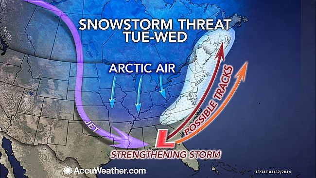
Forecast models are converging on the idea that a large, powerful ocean storm is becoming increasingly likely for next Tuesday into Wednesday, but uncertainty still reigns.
And the details won’t be ironed out today, forecasters say.
“Initially forming off the coast of the southeastern United States, all models are in good agreement that the system will move northeastward and deepen rapidly as a result of a mid-level atmospheric phase,” said John Homenuk, lead forecaster at New York Metro Weather.
Homenuk and his team have produced an easy to understand guide on the current forecasting status of the storm.
What we know
The system is likely to feature rapid pressure falls off the coast, with some models indicating minimum central pressure in the 960s millibars.
The system is likely to feature a large wind field and generate ocean swells.
Coastal impacts are likely regardless of track (wind, waves, etc.).
What we don’t know
The exact track of the system. This will determine how far west precipitation moves and whether or not the system delivers significant winter weather to our area.
The exact timing of the system.
Forecast models are still fluctuating on the precipitation timing and the time period which the system strengthens most.
The eventual degree of impacts in our area. Heavy snow and wind remain possible if the storm tracks further west, but coastal wind and flooding also remain possible with a track out to sea.
As always, stay tuned as the forecast evolves.
WHYY is your source for fact-based, in-depth journalism and information. As a nonprofit organization, we rely on financial support from readers like you. Please give today.

