Plans for 9-mile trail through Wissahickon stumble over section of Germantown Avenue
The Philadelphia region currently has several hundred miles of trails and spurs, where hikers, runners and bikers can travel along the Schuylkill and Delaware Rivers, the Wissahickon and its tributaries, and the Pennypack and Perkiomen creeks.
So does it need one more in Northwest Philadelphia?
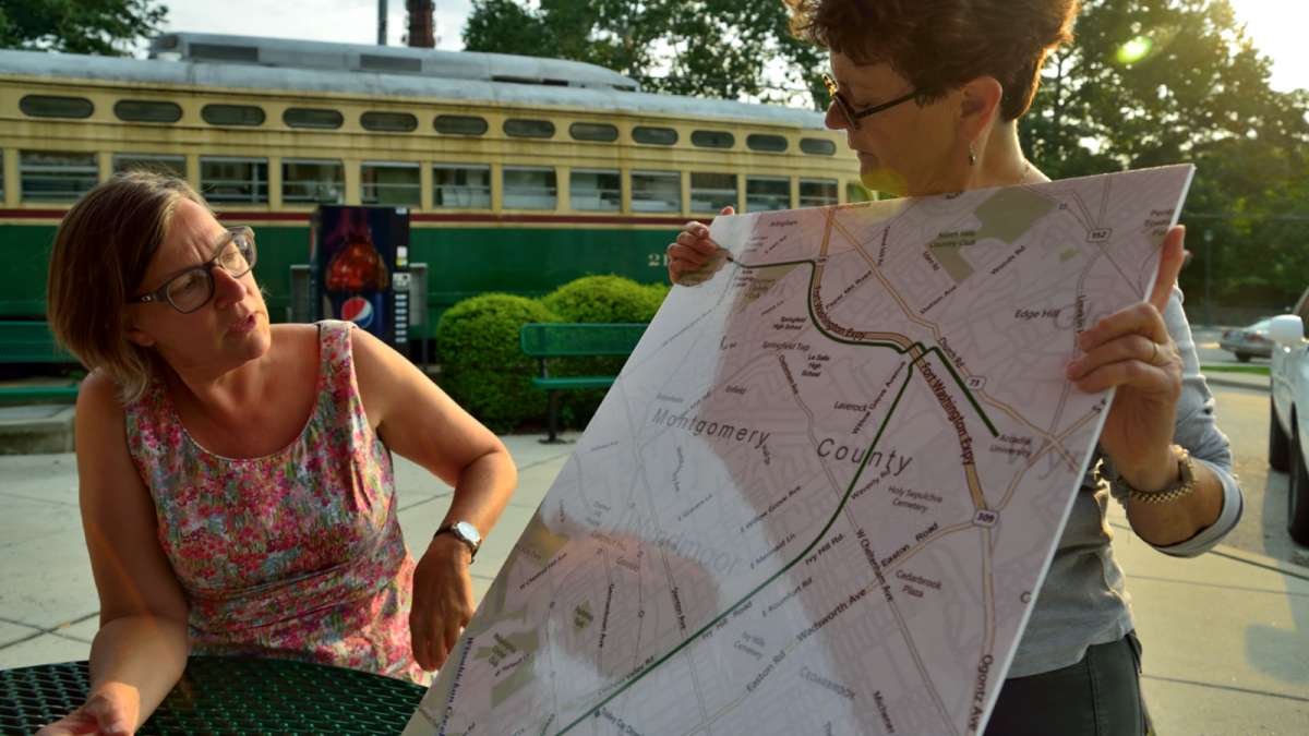
“That’s like saying you’ve got Germantown Avenue here, why do you need Stenton Avenue there?” explained Susan Dannenberg, board chair of the Friends of the Cresheim Trail, a nine-mile project already many years in the planning and building stages. “What cities are doing now is branding an entire trail system. You want to be able to connect, you want to get places, you don’t just want to have isolated trails. While they will get used locally, the idea is to create a network.”
The all-volunteer Friends group dates back to 2007, when a feasibility study looked at how to connect the Wissahickon communities to Springfield, Whitemarsh and Cheltenham townships in Montgomery County. The concept for the trail goes back further, according to local folklore, to proposals first raised by the Chestnut Hill Rotary.
Dannenberg, a Mt. Airy resident who studied city planning and transportation and worked as a customer advocacy officer for SEPTA, joined the Friends in 2011. The group created bylaws and began seeking nonprofit status. “In addition to monthly work days and newsletters, we have set our efforts on getting the organization to build its institutional capacity so we can start soliciting grants and moving this trail forward.”
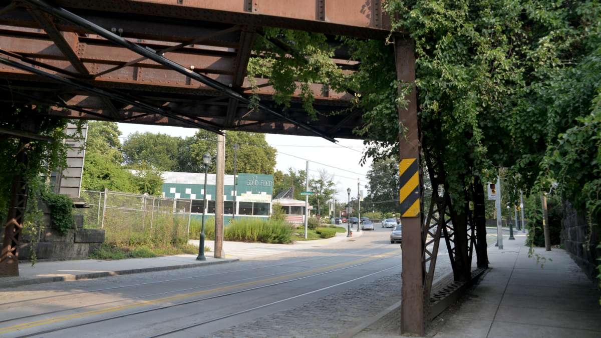
A mile and a half of the Cresheim Trail is already well traveled by walkers and mountain bikers, from the point where Lincoln Drive dead-ends at Allens Lane through a woodsy path to Cresheim Road. By the end of this fall, the Friends say the trail will extend to the defunct trestle over Germantown Avenue, with a spur down to the street.
“The next phase is here,” where Mt. Airy and Chestnut Hill meet, said Friends board member Charlie Karl, a Springfield Township resident.
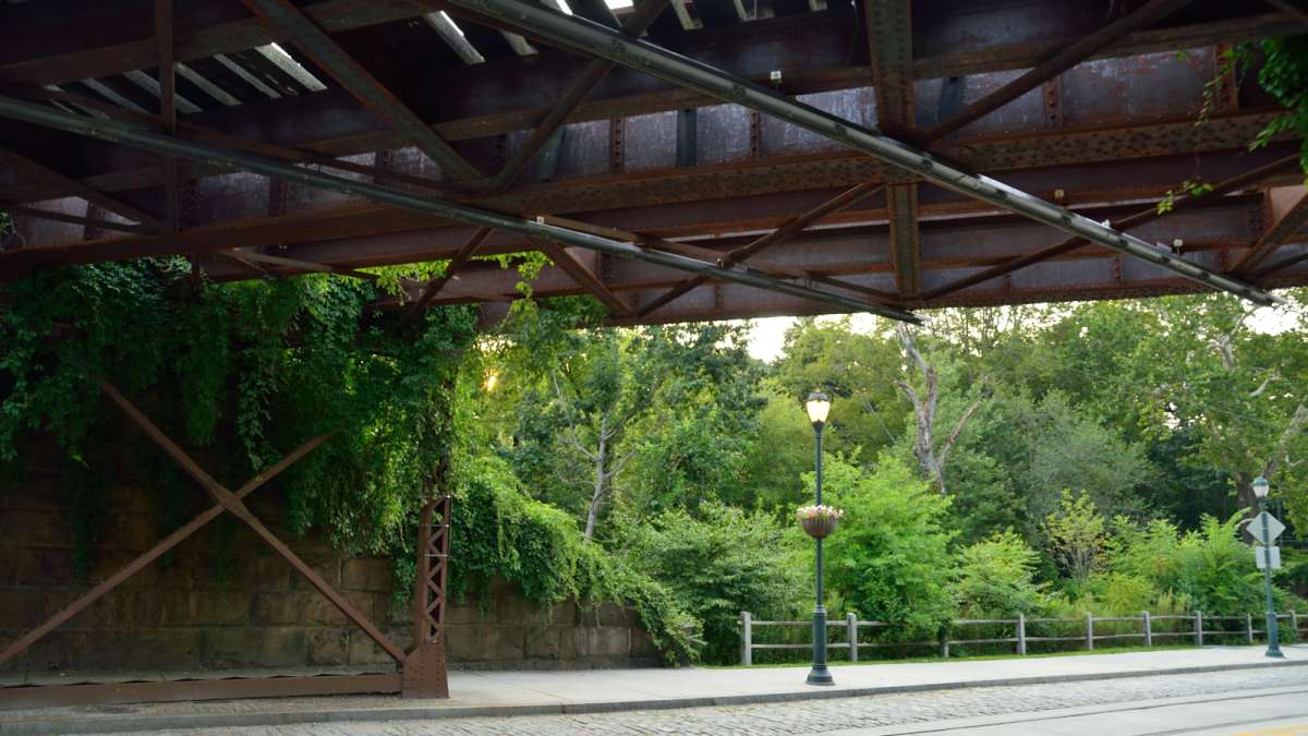
But that long-unused railroad bridge, over one of the busiest intersections on the avenue, is a current stumbling block for the Cresheim Trail.
Deal collapsed
The work achieved by the Friends group so far has been “pretty much sweat equity,” Dannenberg said. But having achieved 501c3 status, the group applied for public grants last December to tackle the work needed on the former Pennsylvania Railroad trestle. PECO, the owner of the bridge, wanted to transfer the liability for the structure and was offering it to the city of Philadelphia’s Department of Parks & Recreation for $1.
The deal fell through last month, when the City Attorney’s Office recommended against the transfer.
“What the Parks department didn’t realize was that the procurement process involved more departments than just them,” Dannenberg said. “It had to go through other people, and the other people wanted hard numbers: What exactly is the liability? Are there environmental hazards? Are there structural hazards? They were saying, we’re not going to take on any structurally deficient bridge. We have plenty of those in our inventory already.”
The Friends’ mission now is “to get those numbers and get the bridge in good shape. That’s going to be complicated because we don’t own it. We hope that the kind of political support and public support that we have, and the eagerness of PECO to divest themselves of this bridge” will result in a solution.
When it looked like the PECO deal was imminent, the Friends raised $10,000 in pledges to match their grant application. “That’s the kind of public support we have for this,” Dannenberg said.
Developer Ken Weinstein has hiked the completed portion of the Cresheim Trail with his son to the family’s Trolley Car Diner on Germantown Avenue, which practically sits in the shadow of the trestle. He has offered $5,000 toward a safety study of the bridge and is waiting for a go-ahead from the city before the environmental study is launched.
The completion of the trail over Germantown Avenue will bring residents from both directions to his restaurant, which he plans to expand next year.
“PECO is in a position now to say, if you’re not taking the bridge, we’re not going to give you the right of way,” Dannenberg said. “Nobody knows if they’ll allow the right of way to be leased out without transferring ownership of the bridge. We hope that they will.”
The bridge was built to bear the passage of two locomotives, and it only ever carried one, Dannenberg said, noting its stone block base and iron infrastructure.
The presence of polychlorinated biphenyls (PCBs) is always a concern with electric railroads, Dannenberg noted, but the line over Germantown Avenue had not been electrified since the 1950s. “In the intervening 60 years, are there PCBs still existing? As far as the bridge is concerned, there is only planking on one side. There’s nothing else there. I don’t understand where the PCBs could be.” Adding a trail will pack soil over the surface, “so I’m not sure what the concern is.”
A key connection
Continuing the Cresheim Trail over Germantown Avenue would connect the already closely tied communities of Mt. Airy and Chestnut Hill. “There’s a lot of interplay between the two, but there’s no way that you can walk or bike safely between them,” Dannenberg said. “There are four connections, but they’re all high-speed roads.”
The Germantown Avenue route, in particular, is “a high-adrenalin drive” by bike, Karl said. “The few times I’ve walked on it, I had to flatten myself along the side of he road.”
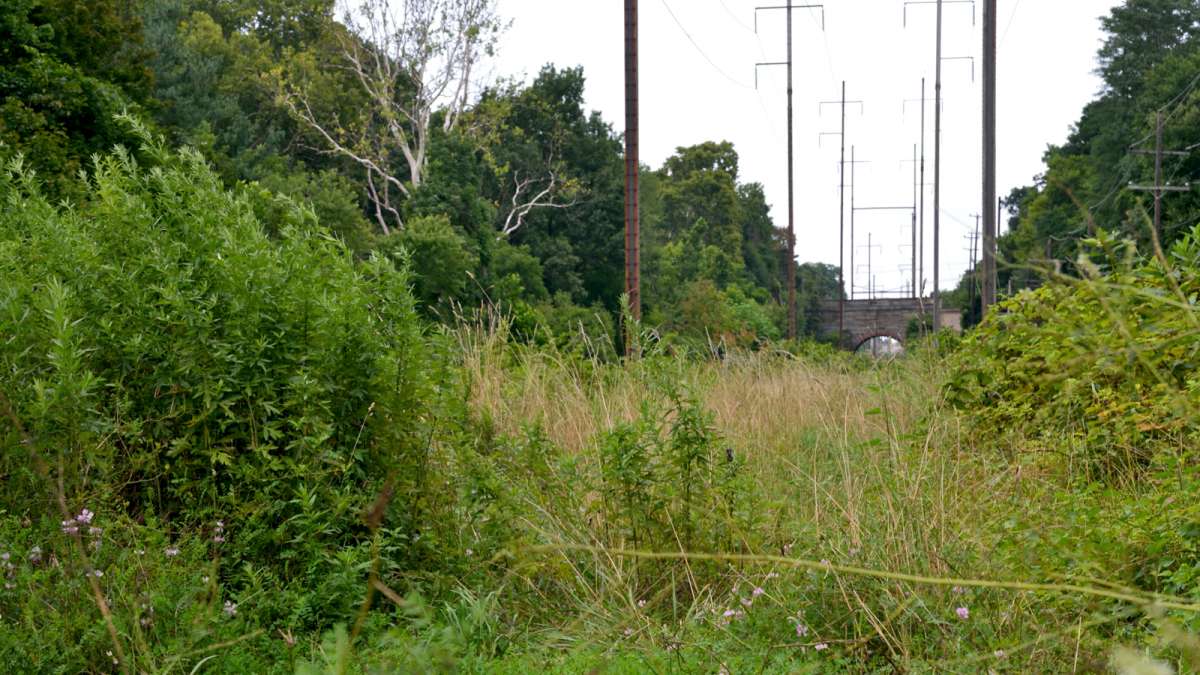
Once the Cresheim Trail is extended over the avenue, there is a straight, sylvan stretch toward Stenton Avenue and Springfield Township. Arcadia University has expressed interest in developing a spur linking the trail to the campus.
The proposed trail would continue toward Fort Washington Park and connect with the sprawling, preserved sections of Erdenheim Farm. It would pass two high schools and provide gentle access to a library, Karl said. It would also provide access for many small communities with street grids that are bicycle-friendly. “When I think of trails, I think of what they mean in terms of not only physical health, but also social health – tying together communities,” said Karl, a recently retired school social worker.
The goal of the trail system, Dannenberg said, is for residents to be able to leave their home and travel for 10 miles in any direction without having to use streets. “It’s about access to green space, access to shopping, to recreation and transportation. The bicycle, particularly in Philadelphia, has become part of the transit system… We are a biking city.”
The planning for the Schuylkill Trail, frequented by bikers, walkers, runners and strollers, began back in the 1970s, Dannenberg noted, and it took 40 years for the completion of the first sections. “When it comes to building trails, you have to have patience.”
NewsWorks has partnered with independent news gatherer PlanPhilly to provide regular, in-depth, timely coverage of planning, zoning and development news. Contact Alan Jaffe at ajaffe@planphilly.com.
WHYY is your source for fact-based, in-depth journalism and information. As a nonprofit organization, we rely on financial support from readers like you. Please give today.


