

Little to no snow at the Jersey Shore Saturday

A single snowflake. (Photo: JSHN contributor John Entwistle)
Record breaking cold tomorrow will give way to precipitation on Saturday, but with temperatures moderating later in the day, forecasters expect mainly rain at the Jersey Shore.
But that’s not before some snow and a wintry mix for a portion of the coast.
The National Weather Service expects precipitation to arrive during the late morning to early afternoon hours, courtesy of a low pressure system tracking north just west of the Appalachian Mountains.
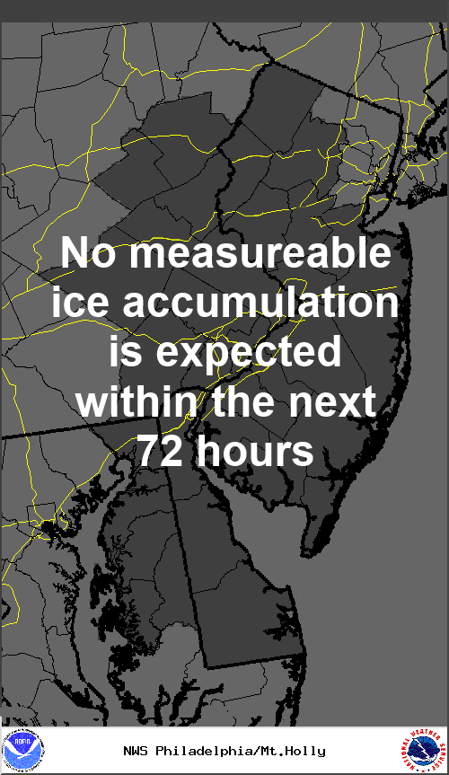
By late afternoon or early evening, snow will change to rain at the shore, and there could be some sleet and a brief period of freezing rain, but icing will not likely be a major issue, according to a National Weather Service briefing.
Up to an inch of snow could fall in northern shore areas, while forecasters do not expect any accumulations in the south, according to a National Weather Service accumulation map.
Friday will start off with temperatures in the single digits to below zero, slowing rising to the middle teens. Wind chill values will be well below zero during the early morning hours.
WHYY is your source for fact-based, in-depth journalism and information. As a nonprofit organization, we rely on financial support from readers like you. Please give today.