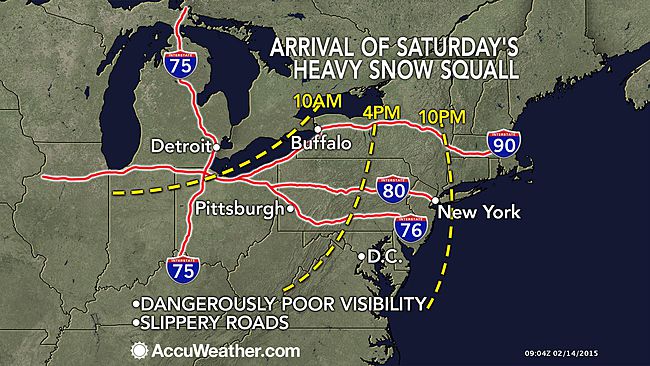
Travel to become difficult as burst of snow arrives this evening

There will be some white-knuckle Valentine’s Day travel tonight.
Travel will become rapidly treacherous this evening as a snow squall associated with an Arctic front moves through the region.
The burst of snow will be driven by gusty winds around 40 to 45 miles per hour, causing low visibilities, according to the National Weather Service.
“The arctic front will behave like a squall line, but instead of bringing heavy rain, it could bring a brief period of heavy snow,” said AccuWeather.com Senior Meteorologist Henry Margusity. “The squall line of snow and the sudden drop of temperature with strong wind gusts can make wet roads slippery in a matter of a couple of minutes and catch motorists off guard.”
The National Weather Service says that motorists should plan for a few hours of difficult travel this evening.
Temperatures will tumble as the Arctic air pours into the region tonight, accompanied by even stronger winds, gusting up to 60 miles per hour.
The wind will also cause some blowing and drifting of snow.
The National Weather Service forecasts three to four inches in northern Monmouth County, two to three inches in southern Monmouth and Ocean counties, and one to two inches in Atlantic and Cape May counties, ending overnight.
Adding in the wind, wind chill values will be sub-zero during that period, dipping to near 10 below zero at the Shore tomorrow, according to NOAA.
Forecasters say to be prepared for power outages and take precautions to protect yourself from the wind and cold.
WHYY is your source for fact-based, in-depth journalism and information. As a nonprofit organization, we rely on financial support from readers like you. Please give today.

