Storms enter Philly, western New Jersey; minor coastal flooding occurring

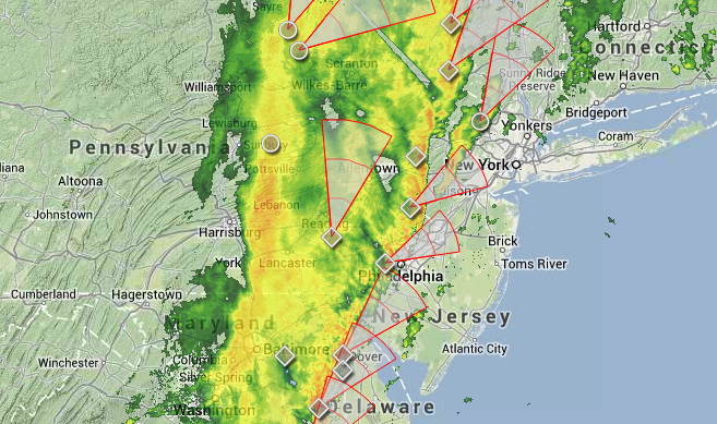
Radar imagery at 2:10 p.m. today. (Image: Weather Underground)
The eastern edge of the line of storms associated with a robust cold front is now entering the area along the Delaware River, including Philadelphia and extreme western New Jersey.
As of 2 p.m., a Severe Thunderstorm Warning is in effect for central Bucks County, PA and Hunterdon County, NJ, where heavy rain and wind gusts are likely. The warning is set to expire at 2:45 p.m.
The afternoon storms are expected to deliver heavy rain and wind gusts for the New Jersey region.
Earlier, the National Weather Service issued a Tornado Watch for the New Jersey area until 5:00 p.m.
Precipitation should be coming to an end from west to east around the latter part of rush hour.
At the coast, minor coastal flooding is occurring in some areas during high tide this afternoon due to a strong southerly/southeasterly flow and continuing high tides following Friday’s new moon.
Jersey Shore Hurricane News contributor Karyn Vagrin Linhardt shares the image on the right from Seaside Park, where water from the Barnegat Bay has entered the roadway this afternoon. This is a common trouble spot.
Elsewhere, Route 40 eastbound in Egg Harbor Township is closed due to minor tidal flooding, according to 511nj.org.
WHYY is your source for fact-based, in-depth journalism and information. As a nonprofit organization, we rely on financial support from readers like you. Please give today.

