Rain tapers off later, flurries possible; black ice threatens tonight

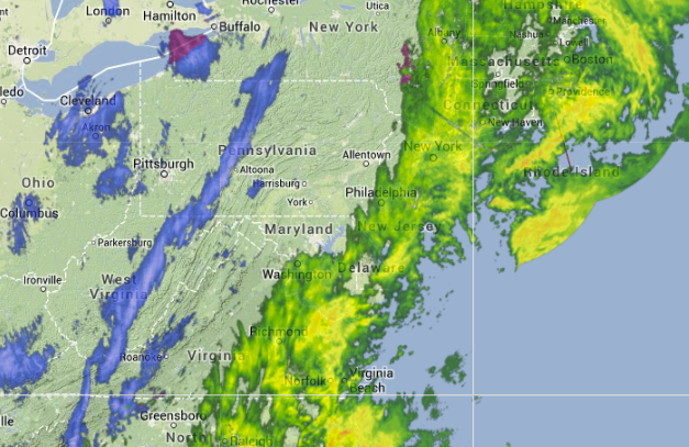
9:30 a.m. radar image. (Image: Weather Underground)
Heavy rain will subside this morning as the low pressure system heads into New England, but with falling temperatures throughout the day, travel tonight may prove to be treacherous due to black ice formation.
With the initial low pressure system to the north of New Jersey, temperatures are now dropping as the winds have shifted from a warm southerly flow to the northwest. Earlier, the National Weather Service office in Mount Holly, NJ advised that the temperatures “will initially drop quickly during the morning, with a slower step down the rest of the day.”
While the heaviest rain “should be done this morning,” according to the National Weather Service, precipitation will taper to showers during the afternoon and possibly flurries for the New Jersey region after sunset. No accumulation is expected. With temperatures dropping back to below freezing for all areas tonight, black ice will be an issue.
After initially subsiding around midday, winds from the northwest will increase this afternoon and evening, approaching wind advisory criteria, according to the National Weather Service. The criteria is met if winds are sustained at 25 to 39 mph and/or gusts to 57 mph.
Thanksgiving will be sunny, windy, and cold, with northwest gusts up to 30 mph and temperatures in the 30s.
WHYY is your source for fact-based, in-depth journalism and information. As a nonprofit organization, we rely on financial support from readers like you. Please give today.

