Forecasters: Weekend storm likely, but precipitation type questions abound

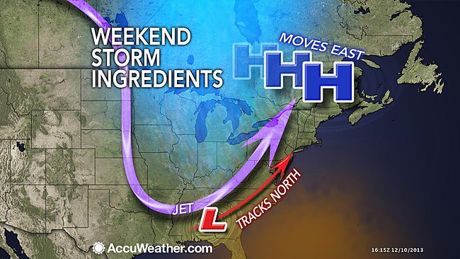
An AccuWeather.com depiction of the weekend storm ingredients.
A storm is brewing and will likely impact the New Jersey region this weekend, but the precipitation type for the area is an open question, forecasters say.
The National Weather Service’s Weather Prediction Center in College Park, MD advises in its latest extended forecast discussion about a “major winter storm” to impact areas from the central Appalachians to the northeast.
But what actually falls from the sky, particularly near the cities along the I-95 corridor, is unclear.
The National Weather Service expects a low pressure system to form in the Lower Mississippi Valley, tracking toward the northeast and intensifying along the Mid-Atlantic coast by the weekend. The timing of the “messy storm,” as described by the National Weather Service office in Mount Holly, NJ, appears to be Saturday afternoon through Sunday morning.
“We will continue to forecast a variety of precipitation types across the [forecast area], with the bulk of the frozen/freezing precipitation north and west of the Interstate 95 corridor,” the office’s latest forecast discussion notes.
Since the forecasting office says that there is “high enough” confidence that there will be precipitation but “lesser confidence” regarding details, stay tuned.
WHYY is your source for fact-based, in-depth journalism and information. As a nonprofit organization, we rely on financial support from readers like you. Please give today.

