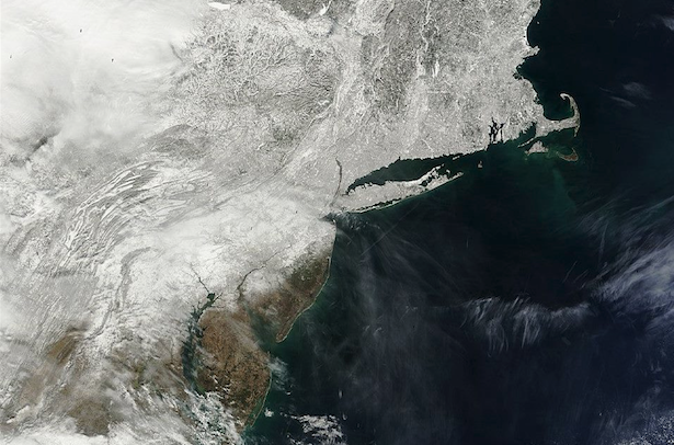
Stunning satellite image of snowpack throughout region

A satellite image from the MODIS instrument taken on February 20, 2014. (Image via the National Weather Service)
If you’re a snow lover, take a good look at this satellite image now, because the green area near the coast will continue to expand.
“With increasing moisture and temperatures, plus the incoming rainfall overnight into tomorrow, the snow pack will be shrinking over the next few days,” the National Weather Service office in New York, NY posted on its Facebook page Thursday afternoon.
The image is courtesy of the Moderate Resolution Imaging Spectroradiometer (MODIS), an instrument aboard the Terra satellite, according to National Aeronautics and Space Administration (NASA). The Aqua satellite also contains the MODIS instrument.
Both MODIS instruments view the entire Earth’s surface every one to two days. Terra passes from north to south across the equator in the morning, while Aqua passes south to north over the equator in the afternoon.
“These data will improve our understanding of global dynamics and processes occurring on the land, in the oceans, and in the lower atmosphere. MODIS is playing a vital role in the development of validated, global, interactive Earth system models able to predict global change accurately enough to assist policy makers in making sound decisions concerning the protection of our environment,” the MODIS website explains.
WHYY is your source for fact-based, in-depth journalism and information. As a nonprofit organization, we rely on financial support from readers like you. Please give today.

