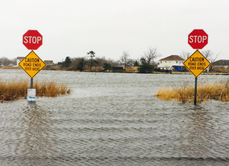
National Weather Service issues Coastal Flood Warning as tidal flooding threat increases

Image courtesy of Marielle (@Gucci80) as shared with JSHN on Twitter.
Widespread moderate tidal flooding is expected this afternoon and evening in a significant portion of the Jersey Shore as a coastal storm approaches offshore.
A Coastal Flood Warning for Atlantic, Ocean, and Monmouth counties is in effect from 2 p.m. until 11 p.m.
After areas of minor tidal flooding throughout the Jersey Shore this morning, the National Weather Service expects a higher surge later (around 4 feet above astronomical tide, compared to 2 to 2.5 feet this morning).
High tide on the oceanfront occurs between 4 and 5 p.m. and later on the back bays and Raritan Bay. Widespread minor to possibly localized moderate tidal flooding is possible Tuesday morning.
The flooding risk is lower in Cape May County, where widespread minor flooding is expected later, with the potential for localized moderate flooding.
Minor tidal flooding this morning impacted roadways that are typically susceptible, according to social media reports.
In addition, heavy rain will be arriving later, tapering off tomorrow morning.
Winds at the coast are already gusting to over 50 miles per hour in some spots this morning. Gusts are expected to increase later today to around 65 miles per hour at the coast and around 50 miles per hour inland.
Conditions will begin improving by tomorrow afternoon.
WHYY is your source for fact-based, in-depth journalism and information. As a nonprofit organization, we rely on financial support from readers like you. Please give today.

