Forecast uncertainty is high for Saturday storm threat, meteorologists say

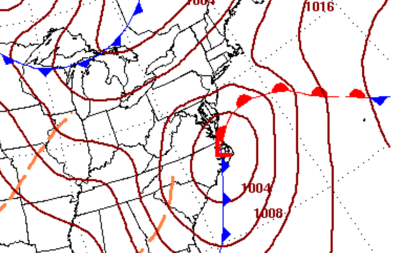
The current surface map forecast for 7 a.m. Saturday, indicating a low pressure system near the Outer Banks in North Carolina. (Image: National Weather Service)
A coastal storm will possibly impact the Jersey Shore on Saturday, but forecasters caution that uncertainties abound.
While the storm is likely to track along the Mid-Atlantic coastline, precipitation types and impacts are far from certain, said John Homenuk, lead forecaster at New York Metro Weather.
“The potential for a significant winter storm? It certainly does exist,” the forecaster said Wednesday afternoon.
But Homenuk cautions that he’s “leaning against a straight-up winter storm at this time,” citing an airmass that is not “necessarily textbook” for East Coast winter storms, the potential for a track that funnels in some warmer air, and the lack of strong high pressure to the north as the storm develops.
“As a result, we get a southerly flow and some warm air in the mid levels while the storm is developing. Dynamics can cool the column eventually, but some precipitation looks likely to be lost to freezing rain, sleet, or rain during the storm,” he said.
The storm’s track, of course, will dictate what types of precipitation will fall.
“If storm track is further west and closer to the coast, it will bring in warmer air off the Atlantic Ocean, changing precipitation to heavy rain – more rain,” according to a graphic issued by the National Weather Service office in New York, NY. “If storm track is further east (east of Long Island), temperatures will be colder, resulting in heavy snow – more snow.”
Homenuk stresses that multiple hazards are possible — heavy snow, hazardous roads and travel, freezing rain, sleet and gusty winds — but says to follow along as the forecast evolves.
“The most advantageous thing to do at this point is to continue to monitor the forecasts,” he said.
WHYY is your source for fact-based, in-depth journalism and information. As a nonprofit organization, we rely on financial support from readers like you. Please give today.

